Saint-Marcory
| Saint-Marcory | |
|---|---|
 | |
 Saint-Marcory | |
|
Location within Nouvelle-Aquitaine region  Saint-Marcory | |
| Coordinates: 44°43′26″N 0°56′01″E / 44.7239°N 0.9336°ECoordinates: 44°43′26″N 0°56′01″E / 44.7239°N 0.9336°E | |
| Country | France |
| Region | Nouvelle-Aquitaine |
| Department | Dordogne |
| Arrondissement | Bergerac |
| Canton | Monpazier |
| Intercommunality | Monpaziérois |
| Government | |
| • Mayor (2008–2014) | Jean Canzian |
| Area1 | 4.76 km2 (1.84 sq mi) |
| Population (2008)2 | 53 |
| • Density | 11/km2 (29/sq mi) |
| Time zone | CET (UTC+1) |
| • Summer (DST) | CEST (UTC+2) |
| INSEE/Postal code | 24446 / 24540 |
| Elevation |
154–252 m (505–827 ft) (avg. 196 m or 643 ft) |
|
1 French Land Register data, which excludes lakes, ponds, glaciers > 1 km² (0.386 sq mi or 247 acres) and river estuaries. 2 Population without double counting: residents of multiple communes (e.g., students and military personnel) only counted once. | |
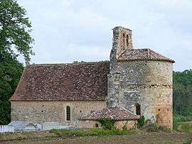
Saint-Marcory is a commune in the Dordogne department in Nouvelle-Aquitaine in southwestern France.
Population
| Historical population | ||
|---|---|---|
| Year | Pop. | ±% |
| 1962 | 88 | — |
| 1968 | 76 | −13.6% |
| 1975 | 69 | −9.2% |
| 1982 | 61 | −11.6% |
| 1990 | 58 | −4.9% |
| 1999 | 58 | +0.0% |
| 2008 | 53 | −8.6% |
See also
References
| Wikimedia Commons has media related to Saint-Marcory. |
This article is issued from Wikipedia - version of the 11/9/2016. The text is available under the Creative Commons Attribution/Share Alike but additional terms may apply for the media files.