Roquesteron
| Roquesteron | ||
|---|---|---|
|
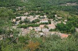
A view of Roquesteron from the nearby hillside | ||
| ||
 Roquesteron | ||
|
Location within Provence-A.-C.d'A. region 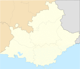 Roquesteron | ||
| Coordinates: 43°52′29″N 7°00′19″E / 43.8747°N 7.0053°ECoordinates: 43°52′29″N 7°00′19″E / 43.8747°N 7.0053°E | ||
| Country | France | |
| Region | Provence-Alpes-Côte d'Azur | |
| Department | Alpes-Maritimes | |
| Arrondissement | Nice | |
| Canton | Roquesteron | |
| Intercommunality | Vallée de l'Estéron | |
| Government | ||
| • Mayor (2008–2014) | André Roumagnac | |
| Area1 | 6.47 km2 (2.50 sq mi) | |
| Population (2008)2 | 539 | |
| • Density | 83/km2 (220/sq mi) | |
| Time zone | CET (UTC+1) | |
| • Summer (DST) | CEST (UTC+2) | |
| INSEE/Postal code | 06106 / 06910 | |
| Elevation |
270–1,040 m (890–3,410 ft) (avg. 340 m or 1,120 ft) | |
|
1 French Land Register data, which excludes lakes, ponds, glaciers > 1 km² (0.386 sq mi or 247 acres) and river estuaries. 2 Population without double counting: residents of multiple communes (e.g., students and military personnel) only counted once. | ||

Roquesteron is a commune in the Alpes-Maritimes department in southeastern France.
History
It was part of the historic County of Nice until 1860 as Roccasterone.
Population
| Historical population | ||
|---|---|---|
| Year | Pop. | ±% |
| 1962 | 221 | — |
| 1968 | 422 | +91.0% |
| 1975 | 404 | −4.3% |
| 1982 | 428 | +5.9% |
| 1990 | 509 | +18.9% |
| 1999 | 478 | −6.1% |
| 2008 | 539 | +12.8% |
See also
References
| Wikimedia Commons has media related to Roquesteron. |
This article is issued from Wikipedia - version of the 1/30/2015. The text is available under the Creative Commons Attribution/Share Alike but additional terms may apply for the media files.