Wichelen
| Wichelen | |||
|---|---|---|---|
| Municipality | |||
| |||
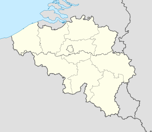 Wichelen Location in Belgium | |||
|
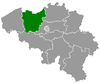
Location of Wichelen in East Flanders 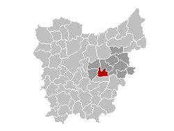 | |||
| Coordinates: 51°00′N 03°58′E / 51.000°N 3.967°ECoordinates: 51°00′N 03°58′E / 51.000°N 3.967°E | |||
| Country | Belgium | ||
| Community | Flemish Community | ||
| Region | Flemish Region | ||
| Province | East Flanders | ||
| Arrondissement | Dendermonde | ||
| Government | |||
| • Mayor | Kenneth Taylor | ||
| • Governing party/ies | Samen, SP.A-Spirit | ||
| Area | |||
| • Total | 22.87 km2 (8.83 sq mi) | ||
| Population (1 January 2016)[1] | |||
| • Total | 11,501 | ||
| • Density | 500/km2 (1,300/sq mi) | ||
| Postal codes | 9260 | ||
| Area codes | 09 | ||
| Website | www.wichelen.be | ||


Wichelen (Dutch pronunciation: [ˈʋɪxələ(n)]) is a municipality located in the Denderstreek in the Belgian province of East Flanders. The municipality comprises the towns of Schellebelle, Serskamp and Wichelen proper. On January 1, 2006, Wichelen had a total population of 11,145. The total area is 22.87 km² which gives a population density of 487 inhabitants per km².
Wichelen is crossed by the Molenbeek in Schellebelle, Serskamp and Wichelen.
Gallery
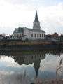 The church of Schellebelle overlooks the Scheldt
_-_Church.jpg) Sint-Denijs church in Serskamp
Sint-Denijs church in Serskamp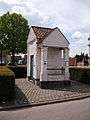 Former "roephuisje" and prison for one person in Schellebelle
References
- ↑ Population per municipality as of 1 January 2016 (XLS; 397 KB)
External links
 Media related to Wichelen at Wikimedia Commons
- Official website (Dutch)
- The reference for Wichelen (Dutch)
 |
Laarne | Berlare | | |
| Wetteren | |
Dendermonde | ||
| ||||
| | ||||
| Lede |
This article is issued from Wikipedia - version of the 11/30/2016. The text is available under the Creative Commons Attribution/Share Alike but additional terms may apply for the media files.