Syringa, Virginia
| Syringa, Virginia | |
|---|---|
| Unincorporated community | |
 Syringa, Virginia  Syringa, Virginia | |
| Coordinates: 37°34′44″N 76°27′24″W / 37.57889°N 76.45667°WCoordinates: 37°34′44″N 76°27′24″W / 37.57889°N 76.45667°W | |
| Country | United States |
| State | Virginia |
| County | Middlesex |
| Elevation | 56 ft (17 m) |
| Time zone | Eastern (EST) (UTC-5) |
| • Summer (DST) | EDT (UTC-4) |
| ZIP code | 23169[1] |
| Area code(s) | 804 |
| GNIS feature ID | 1475417[2] |
Syringa is an unincorporated community in Middlesex County, Virginia, United States. Syringa is 7.8 miles (12.6 km) east-southeast of Saluda. Syringa had a post office, which closed on September 3, 1988.[3]
References
- ↑ United States Postal Service (2012). "USPS - Look Up a ZIP Code". Retrieved 2012-02-15.
- ↑ "Syringa". Geographic Names Information System. United States Geological Survey.
- ↑ "Postmaster Finder - Post Offices by ZIP Code". United States Postal Service. Retrieved August 21, 2012.
Municipalities and communities of Middlesex County, Virginia, United States | ||
|---|---|---|
| Town | 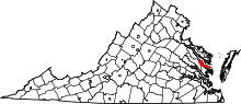 | |
| CDPs | ||
| Unincorporated communities | ||
| Footnotes | ‡This populated place also has portions in an adjacent county or counties | |
This article is issued from Wikipedia - version of the 7/27/2016. The text is available under the Creative Commons Attribution/Share Alike but additional terms may apply for the media files.