Zar, Armenia
For people named Zarr, see Zarr (surname).
Coordinates: 40°15′40″N 44°44′10″E / 40.26111°N 44.73611°E
| Zar Զառ | |
|---|---|
|
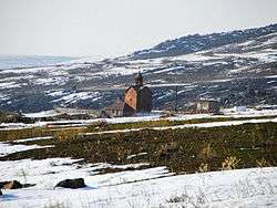
Surp Karapet Church in Zar | |
 Zar | |
| Coordinates: 40°15′40″N 44°44′10″E / 40.26111°N 44.73611°E | |
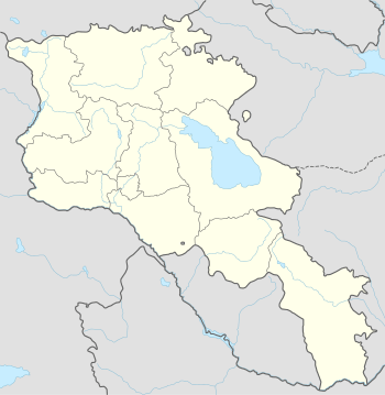
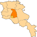
| Country | Armenia |
| Marz (Province) | Kotayk |
| Population (2008) | |
| • Total | 1,456 |
| Time zone | (UTC+4) |
Zar (Armenian: Զառ), is a village in the Kotayk Province of Armenia.
References
- Zar, Armenia at GEOnet Names Server
- World Gazeteer: Armenia – World-Gazetteer.com
- Report of the results of the 2001 Armenian Census, National Statistical Service of the Republic of Armenia
This article is issued from Wikipedia - version of the 9/11/2016. The text is available under the Creative Commons Attribution/Share Alike but additional terms may apply for the media files.