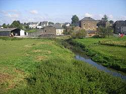
Étalle, Belgium
| Étalle | |||
|---|---|---|---|
| Municipality | |||
 | |||
| |||
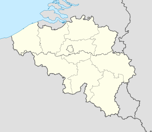 Étalle Location in Belgium | |||
|
Location of Étalle in Luxembourg province 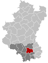 | |||
| Coordinates: 49°41′N 05°36′E / 49.683°N 5.600°ECoordinates: 49°41′N 05°36′E / 49.683°N 5.600°E | |||
| Country | Belgium | ||
| Community | French Community | ||
| Region | Wallonia | ||
| Province | Luxembourg | ||
| Arrondissement | Virton | ||
| Government | |||
| • Mayor | Guy Charlier | ||
| • Governing party/ies | Mayeur | ||
| Area | |||
| • Total | 78.10 km2 (30.15 sq mi) | ||
| Population (1 January 2016)[1] | |||
| • Total | 5,746 | ||
| • Density | 74/km2 (190/sq mi) | ||
| Postal codes | 6740-6743 | ||
| Area codes | 063 | ||
| Website |
etalle | ||

.svg.png)
Étalle is a Walloon municipality of Belgium located in the province of Luxembourg. On 1 January 2007 the municipality, which covers 78.1 km², had 5,389 inhabitants, giving a population density of 69 inhabitants per km².
The municipality consists of the following sub-municipalities: Étalle proper, Buzenol, Chantemelle, Sainte-Marie, Vance, and Villers-sur-Semois. Other population centers include: Croix Rouge, Fratin, Huombois, and Sivry.
See also
References
- ↑ Population per municipality as of 1 January 2016 (XLS; 397 KB)
External links
-
 Media related to Étalle, Belgium at Wikimedia Commons
 |
Habay | | ||
| Tintigny | |
Arlon | ||
| ||||
| | ||||
| Virton, Saint-Léger |
Municipalities of Luxembourg Province | ||
|---|---|---|
| Arlon | 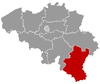 | |
| Bastogne | ||
| Marche-en-Famenne | ||
| Neufchâteau | ||
| Virton | ||
This article is issued from Wikipedia - version of the 12/1/2016. The text is available under the Creative Commons Attribution/Share Alike but additional terms may apply for the media files.