Rouvroy, Belgium
For other uses, see Rouvroy.
| Rouvroy | |||
|---|---|---|---|
| Municipality | |||
|
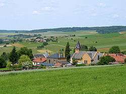
Torgny, southernmost place in Belgium | |||
| |||
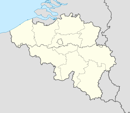 Rouvroy Location in Belgium | |||
|
Location of Rouvroy in Luxembourg province 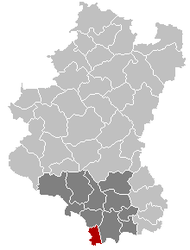 | |||
| Coordinates: 49°32.3′N 5°29.45′E / 49.5383°N 5.49083°ECoordinates: 49°32.3′N 5°29.45′E / 49.5383°N 5.49083°E | |||
| Country | Belgium | ||
| Community | French Community | ||
| Region | Wallonia | ||
| Province | Luxembourg | ||
| Arrondissement | Virton | ||
| Government | |||
| • Mayor | Carmen Ramlot | ||
| • Governing party/ies | EC | ||
| Area | |||
| • Total | 27.68 km2 (10.69 sq mi) | ||
| Population (1 January 2016)[1] | |||
| • Total | 2,094 | ||
| • Density | 76/km2 (200/sq mi) | ||
| Postal codes | 6767 | ||
| Area codes | 063 | ||
| Website | (French) rouvroy.be | ||

.svg.png)
Rouvroy is a Walloon municipality of Belgium located in the province of Luxembourg. On 1 January 2007 the municipality, which covers 27.68 km², had 2,007 inhabitants, giving a population density of 72.5 inhabitants per km². Belgium's southernmost point is situated in the municipality, at Torgny.
Formed in 1976, the municipality consists of the following sub-municipalities: Rouvroy proper, Dampicourt, Harnoncourt, Lamorteau, and Torgny. Other population centers include: Couvreux and Montquintin.
See also
References
- ↑ Population per municipality as of 1 January 2016 (XLS; 397 KB)
External links
-
 Media related to Rouvroy, Belgium at Wikimedia Commons
 |
Thonne-la-Long (FR-55) | Meix-devant-Virton | | |
| Écouviez (FR-55) | |
Virton | ||
| ||||
| | ||||
| Velosnes (FR-55) | Épiez-sur-Chiers (FR-54) |
Municipalities of Luxembourg Province | ||
|---|---|---|
| Arlon | 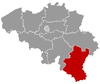 | |
| Bastogne | ||
| Marche-en-Famenne | ||
| Neufchâteau | ||
| Virton | ||
This article is issued from Wikipedia - version of the 12/1/2016. The text is available under the Creative Commons Attribution/Share Alike but additional terms may apply for the media files.