Avesnes-en-Bray
| Avesnes-en-Bray | |
|---|---|
 Avesnes-en-Bray | |
|
Location within Normandy region 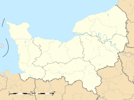 Avesnes-en-Bray | |
| Coordinates: 49°28′11″N 1°40′24″E / 49.4697°N 1.6733°ECoordinates: 49°28′11″N 1°40′24″E / 49.4697°N 1.6733°E | |
| Country | France |
| Region | Normandy |
| Department | Seine-Maritime |
| Arrondissement | Dieppe |
| Canton | Gournay-en-Bray |
| Intercommunality | Canton of Gournay-en-Bray |
| Area1 | 11.9 km2 (4.6 sq mi) |
| Population (2006)2 | 311 |
| • Density | 26/km2 (68/sq mi) |
| Time zone | CET (UTC+1) |
| • Summer (DST) | CEST (UTC+2) |
| INSEE/Postal code | 76048 / 76220 |
| Elevation |
102–229 m (335–751 ft) (avg. 136 m or 446 ft) |
|
1 French Land Register data, which excludes lakes, ponds, glaciers > 1 km² (0.386 sq mi or 247 acres) and river estuaries. 2 Population without double counting: residents of multiple communes (e.g., students and military personnel) only counted once. | |
Avesnes-en-Bray is a commune in the Seine-Maritime department in the Haute-Normandie region in northern France.
Geography
A small farming village in the Pays de Bray, situated some 28 miles (45 km) east of Rouen, at the junction of the N31 and D221 roads.
Population
| Year | 1962 | 1968 | 1975 | 1982 | 1990 | 1999 | 2006 |
|---|---|---|---|---|---|---|---|
| Population | 275 | 275 | 249 | 205 | 234 | 256 | 311 |
| From the year 1962 on: No double counting—residents of multiple communes (e.g. students and military personnel) are counted only once. | |||||||
Places of interest
- The eighteenth century church of St.Martin.
- Some Merovingian tombs and objects, found in the 19th century.
See also
References
External links
| Wikimedia Commons has media related to Avesnes-en-Bray. |
- Avesnes-en-Bray on the Quid website (French)
This article is issued from Wikipedia - version of the 10/22/2016. The text is available under the Creative Commons Attribution/Share Alike but additional terms may apply for the media files.