Sainte-Colombe, Seine-Maritime
| Sainte-Colombe | ||
|---|---|---|
| ||
 Sainte-Colombe | ||
|
Location within Normandy region 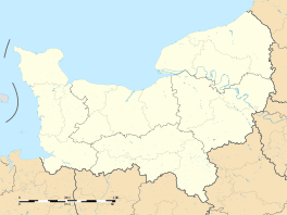 Sainte-Colombe | ||
| Coordinates: 49°48′03″N 0°45′37″E / 49.8008°N 0.7603°ECoordinates: 49°48′03″N 0°45′37″E / 49.8008°N 0.7603°E | ||
| Country | France | |
| Region | Normandy | |
| Department | Seine-Maritime | |
| Arrondissement | Dieppe | |
| Canton | Saint-Valery-en-Caux | |
| Intercommunality | Côte d'Albâtre | |
| Government | ||
| • Mayor | Eugène Roussel | |
| Area1 | 5.74 km2 (2.22 sq mi) | |
| Population (2006)2 | 205 | |
| • Density | 36/km2 (92/sq mi) | |
| Time zone | CET (UTC+1) | |
| • Summer (DST) | CEST (UTC+2) | |
| INSEE/Postal code | 76569 / 76460 | |
| Elevation |
77–114 m (253–374 ft) (avg. 103 m or 338 ft) | |
|
1 French Land Register data, which excludes lakes, ponds, glaciers > 1 km² (0.386 sq mi or 247 acres) and river estuaries. 2 Population without double counting: residents of multiple communes (e.g., students and military personnel) only counted once. | ||
.svg.png)
Sainte-Colombe is a commune in the Seine-Maritime department in the Haute-Normandie region in northern France.
Geography
A small farming village situated in the Pays de Caux, some 17 miles (27 km) southwest of Dieppe at the junction of the D20 and the D75 roads.
Population
| 1962 | 1968 | 1975 | 1982 | 1990 | 1999 | 2006 |
|---|---|---|---|---|---|---|
| 228 | 248 | 231 | 231 | 177 | 194 | 205 |
| Starting in 1962: Population without duplicates | ||||||
Places of interest
- The church of St. Colombe, dating from the sixteenth century.
See also
References
External links
| Wikimedia Commons has media related to Sainte-Colombe (Seine-Maritime). |
- Sainte-Colombe on the Quid website (French)
This article is issued from Wikipedia - version of the 7/13/2016. The text is available under the Creative Commons Attribution/Share Alike but additional terms may apply for the media files.