Bertheauville
| Bertheauville | ||
|---|---|---|
| ||
 Bertheauville | ||
|
Location within Normandy region 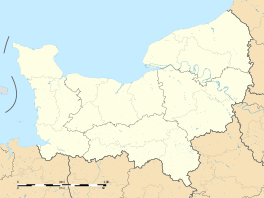 Bertheauville | ||
| Coordinates: 49°45′20″N 0°35′44″E / 49.7556°N 0.5956°ECoordinates: 49°45′20″N 0°35′44″E / 49.7556°N 0.5956°E | ||
| Country | France | |
| Region | Normandy | |
| Department | Seine-Maritime | |
| Arrondissement | Dieppe | |
| Canton | Cany-Barville | |
| Intercommunality | Côte d'Albâtre | |
| Government | ||
| • Mayor | Olivier Tassell | |
| Area1 | 2.43 km2 (0.94 sq mi) | |
| Population (2006)2 | 119 | |
| • Density | 49/km2 (130/sq mi) | |
| Time zone | CET (UTC+1) | |
| • Summer (DST) | CEST (UTC+2) | |
| INSEE/Postal code | 76083 / 76450 | |
| Elevation |
49–120 m (161–394 ft) (avg. 110 m or 360 ft) | |
|
1 French Land Register data, which excludes lakes, ponds, glaciers > 1 km² (0.386 sq mi or 247 acres) and river estuaries. 2 Population without double counting: residents of multiple communes (e.g., students and military personnel) only counted once. | ||
.svg.png)
Bertheauville is a commune in the Seine-Maritime department in the Haute-Normandie region in northern France.
Geography
A very small farming village in the Pays de Caux, situated some 27 miles (43 km) southwest of Dieppe, at the junction of the D10 and D210 roads.
Population
| Year | 1962 | 1968 | 1975 | 1982 | 1990 | 1999 | 2006 |
|---|---|---|---|---|---|---|---|
| Population | 132 | 115 | 84 | 60 | 75 | 85 | 119 |
| From the year 1962 on: No double counting—residents of multiple communes (e.g. students and military personnel) are counted only once. | |||||||
Places of interest
- The church of Notre-Dame, built in the 18th century.
See also
References
External links
| Wikimedia Commons has media related to Bertheauville. |
- Bertheauville on the Quid website (French)
This article is issued from Wikipedia - version of the 10/31/2016. The text is available under the Creative Commons Attribution/Share Alike but additional terms may apply for the media files.