Osmoy-Saint-Valery
| Osmoy-Saint-Valery | |
|---|---|
|
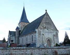
Notre-Dame church in Osmoy. | |
 Osmoy-Saint-Valery | |
|
Location within Normandy region 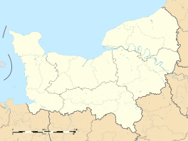 Osmoy-Saint-Valery | |
| Coordinates: 49°47′50″N 1°19′23″E / 49.7972°N 1.3231°ECoordinates: 49°47′50″N 1°19′23″E / 49.7972°N 1.3231°E | |
| Country | France |
| Region | Normandy |
| Department | Seine-Maritime |
| Arrondissement | Dieppe |
| Canton | Londinières |
| Intercommunality | Communauté de communes de Londinières |
| Government | |
| • Mayor (2014-2020) | Daniel Demonchy |
| Area1 | 16.21 km2 (6.26 sq mi) |
| Population (2011)2 | 333 |
| • Density | 21/km2 (53/sq mi) |
| Time zone | CET (UTC+1) |
| • Summer (DST) | CEST (UTC+2) |
| INSEE/Postal code | 76487 / 76660 |
| Elevation |
40–193 m (131–633 ft) (avg. 56 m or 184 ft) |
|
1 French Land Register data, which excludes lakes, ponds, glaciers > 1 km² (0.386 sq mi or 247 acres) and river estuaries. 2 Population without double counting: residents of multiple communes (e.g., students and military personnel) only counted once. | |
Osmoy-Saint-Valery is a commune in the Seine-Maritime department in the Haute-Normandie region in north-western France.
Geography
A farming village situated by the banks of the Béthune River in the Pays de Bray at the junction of the D 1 and the D 77 roads, some 15 miles (24 km) southeast of Dieppe.
History
Commune created in 1823 by the fusion of the three communes of Maintru, Osmoy and Saint-Velery-sous-Bures.
Population
| Historical population | ||
|---|---|---|
| Year | Pop. | ±% |
| 1793 | 133 | — |
| 1800 | 135 | +1.5% |
| 1806 | 150 | +11.1% |
| 1821 | 154 | +2.7% |
| 1831 | 607 | +294.2% |
| 1836 | 610 | +0.5% |
| 1841 | 616 | +1.0% |
| 1846 | 613 | −0.5% |
| 1851 | 572 | −6.7% |
| 1856 | 542 | −5.2% |
| 1861 | 526 | −3.0% |
| 1866 | 504 | −4.2% |
| 1872 | 464 | −7.9% |
| 1876 | 505 | +8.8% |
| 1881 | 520 | +3.0% |
| 1886 | 477 | −8.3% |
| 1891 | 486 | +1.9% |
| 1896 | 478 | −1.6% |
| 1901 | 419 | −12.3% |
| 1906 | 450 | +7.4% |
| 1911 | 441 | −2.0% |
| 1921 | 413 | −6.3% |
| 1926 | 442 | +7.0% |
| 1931 | 415 | −6.1% |
| 1936 | 420 | +1.2% |
| 1946 | 433 | +3.1% |
| 1954 | 400 | −7.6% |
| 1962 | 360 | −10.0% |
| 1968 | 324 | −10.0% |
| 1975 | 332 | +2.5% |
| 1982 | 293 | −11.7% |
| 1990 | 299 | +2.0% |
| 1999 | 310 | +3.7% |
| 2006 | 328 | +5.8% |
| 2007 | 331 | +0.9% |
| 2011 | 333 | +0.6% |
Places of interest
- The church of Notre-Dame, dating from the twelfth century.
- The chapel at Maintru.
- A sixteenth-century stone cross.
- The manorhouse de La Valouine, built in 1602 by the seigneurs de Ricarville.
See also
References
External links
| Wikimedia Commons has media related to Osmoy-Saint-Valery. |
This article is issued from Wikipedia - version of the 11/29/2014. The text is available under the Creative Commons Attribution/Share Alike but additional terms may apply for the media files.