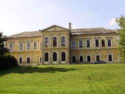
Bohdalice-Pavlovice
| Bohdalice-Pavlovice | |||
|---|---|---|---|
| Municipality | |||
 | |||
| |||
 Bohdalice-Pavlovice | |||
| Coordinates: 49°13′18″N 17°2′39″E / 49.22167°N 17.04417°ECoordinates: 49°13′18″N 17°2′39″E / 49.22167°N 17.04417°E | |||
| Country |
| ||
| Region | South Moravian | ||
| District | Vyškov | ||
| Area | |||
| • Total | 8.91 km2 (3.44 sq mi) | ||
| Elevation | 314 m (1,030 ft) | ||
| Population (2008) | |||
| • Total | 809 | ||
| • Density | 91/km2 (240/sq mi) | ||
| Postal code | 683 41 | ||
| Website | http://vetrnik-obce.cz | ||
Bohdalice-Pavlovice is a village and municipality (obec) in Vyškov District in the South Moravian Region of the Czech Republic.
The municipality covers an area of 8.91 square kilometres (3.44 sq mi), and has a population of 809 (as at 25 February 2008).
Bohdalice-Pavlovice lies approximately 7 kilometres (4 mi) south-east of Vyškov, 32 km (20 mi) east of Brno, and 213 km (132 mi) south-east of Prague.
References
| Wikimedia Commons has media related to Bohdalice-Pavlovice. |
This article is issued from Wikipedia - version of the 4/7/2016. The text is available under the Creative Commons Attribution/Share Alike but additional terms may apply for the media files.