Prugny
| Prugny | ||
|---|---|---|
.JPG) | ||
| ||
 Prugny | ||
|
Location within Grand Est region 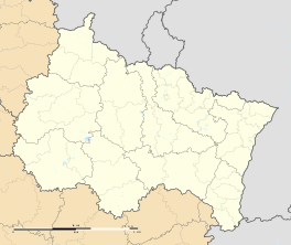 Prugny | ||
| Coordinates: 48°14′49″N 3°56′42″E / 48.2469°N 3.945°ECoordinates: 48°14′49″N 3°56′42″E / 48.2469°N 3.945°E | ||
| Country | France | |
| Region | Grand Est | |
| Department | Aube | |
| Arrondissement | Troyes | |
| Canton | Estissac | |
| Intercommunality | Portes du Pays d'Othe | |
| Government | ||
| • Mayor (2008–2014) | Philippe Cotel | |
| Area1 | 8.62 km2 (3.33 sq mi) | |
| Population (2008)2 | 421 | |
| • Density | 49/km2 (130/sq mi) | |
| Time zone | CET (UTC+1) | |
| • Summer (DST) | CEST (UTC+2) | |
| INSEE/Postal code | 10307 / 10190 | |
| Elevation |
172–260 m (564–853 ft) (avg. 190 m or 620 ft) | |
|
1 French Land Register data, which excludes lakes, ponds, glaciers > 1 km² (0.386 sq mi or 247 acres) and river estuaries. 2 Population without double counting: residents of multiple communes (e.g., students and military personnel) only counted once. | ||

Prugny is a commune in the Aube department in north-central France.
Population
| Historical population | ||
|---|---|---|
| Year | Pop. | ±% |
| 1962 | 82 | — |
| 1968 | 92 | +12.2% |
| 1975 | 145 | +57.6% |
| 1982 | 259 | +78.6% |
| 1990 | 300 | +15.8% |
| 1999 | 315 | +5.0% |
| 2008 | 421 | +33.7% |
See also
References
| Wikimedia Commons has media related to Prugny. |
This article is issued from Wikipedia - version of the 2/11/2016. The text is available under the Creative Commons Attribution/Share Alike but additional terms may apply for the media files.