Saint-Bonnet-du-Gard
| Saint-Bonnet-du-Gard | ||
|---|---|---|
|
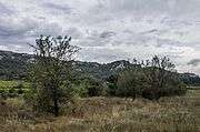
A general view of Saint-Bonnet-du-Gard | ||
| ||
 Saint-Bonnet-du-Gard | ||
|
Location within Occitanie region  Saint-Bonnet-du-Gard | ||
| Coordinates: 43°55′40″N 4°32′46″E / 43.9278°N 4.5461°ECoordinates: 43°55′40″N 4°32′46″E / 43.9278°N 4.5461°E | ||
| Country | France | |
| Region | Occitanie | |
| Department | Gard | |
| Arrondissement | Nîmes | |
| Canton | Aramon | |
| Intercommunality | Pont du Gard | |
| Government | ||
| • Mayor (2008–2014) | Sandrine Péridier | |
| Area1 | 6.84 km2 (2.64 sq mi) | |
| Population (2008)2 | 642 | |
| • Density | 94/km2 (240/sq mi) | |
| Time zone | CET (UTC+1) | |
| • Summer (DST) | CEST (UTC+2) | |
| INSEE/Postal code | 30235 / 30210 | |
| Elevation |
26–170 m (85–558 ft) (avg. 30 m or 98 ft) | |
|
1 French Land Register data, which excludes lakes, ponds, glaciers > 1 km² (0.386 sq mi or 247 acres) and river estuaries. 2 Population without double counting: residents of multiple communes (e.g., students and military personnel) only counted once. | ||
.jpg)
.svg.png)
Saint-Bonnet-du-Gard is a commune in the Gard department in southern France.
Population
| Historical population | ||
|---|---|---|
| Year | Pop. | ±% |
| 1962 | 294 | — |
| 1968 | 300 | +2.0% |
| 1975 | 316 | +5.3% |
| 1982 | 358 | +13.3% |
| 1990 | 372 | +3.9% |
| 1999 | 579 | +55.6% |
| 2008 | 642 | +10.9% |
Gallery

See also
References
| Wikimedia Commons has media related to Saint-Bonnet-du-Gard. |
This article is issued from Wikipedia - version of the 11/8/2016. The text is available under the Creative Commons Attribution/Share Alike but additional terms may apply for the media files.