Valaurie
| Valaurie | |
|---|---|
 | |
 Valaurie | |
|
Location within Auvergne-Rhône-Alpes region  Valaurie | |
| Coordinates: 44°25′23″N 4°48′50″E / 44.423°N 4.814°ECoordinates: 44°25′23″N 4°48′50″E / 44.423°N 4.814°E | |
| Country | France |
| Region | Auvergne-Rhône-Alpes |
| Department | Drôme |
| Arrondissement | Nyons |
| Canton | Grignan |
| Government | |
| • Mayor (2008–2014) | Luc Chambonnet |
| Area1 | 12.3 km2 (4.7 sq mi) |
| Population (2008)2 | 534 |
| • Density | 43/km2 (110/sq mi) |
| Time zone | CET (UTC+1) |
| • Summer (DST) | CEST (UTC+2) |
| INSEE/Postal code | 26360 / 26230 |
| Elevation |
80–290 m (260–950 ft) (avg. 168 m or 551 ft) |
|
1 French Land Register data, which excludes lakes, ponds, glaciers > 1 km² (0.386 sq mi or 247 acres) and river estuaries. 2 Population without double counting: residents of multiple communes (e.g., students and military personnel) only counted once. | |
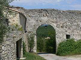
Valaurie is a commune in the Drôme department in southeastern France. One important landmark is the Church of St. Martin in Valaurie.
Population
| Historical population | ||
|---|---|---|
| Year | Pop. | ±% |
| 1911 | 388 | — |
| 1962 | 262 | −32.5% |
| 1968 | 269 | +2.7% |
| 1975 | 278 | +3.3% |
| 1982 | 365 | +31.3% |
| 1990 | 386 | +5.8% |
| 1999 | 509 | +31.9% |
| 2008 | 534 | +4.9% |
See also
References
| Wikimedia Commons has media related to Valaurie. |
This article is issued from Wikipedia - version of the 10/28/2016. The text is available under the Creative Commons Attribution/Share Alike but additional terms may apply for the media files.