Weißkirchen an der Traun
| Weißkirchen an der Traun | ||
|---|---|---|
 | ||
| ||
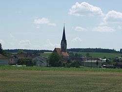
 Weißkirchen an der Traun Location within Austria | ||
| Coordinates: 48°09′53″N 14°07′42″E / 48.16472°N 14.12833°ECoordinates: 48°09′53″N 14°07′42″E / 48.16472°N 14.12833°E | ||
| Country | Austria | |
| State | Upper Austria | |
| District | Wels-Land | |
| Government | ||
| • Mayor | Norbert Höpoldseder (SPÖ) | |
| Area | ||
| • Total | 22 km2 (8 sq mi) | |
| Elevation | 305 m (1,001 ft) | |
| Population (14 June 2016)[1] | ||
| • Total | 3,346 | |
| • Density | 150/km2 (390/sq mi) | |
| Time zone | CET (UTC+1) | |
| • Summer (DST) | CEST (UTC+2) | |
| Postal code | 4616 | |
| Area code | 07243 | |
| Vehicle registration | WL | |
| Website | www.weisskirchen.at | |

Weißkirchen an der Traun is a municipality in the district of Wels-Land in the Austrian state of Upper Austria.
Population
| Historical population | ||
|---|---|---|
| Year | Pop. | ±% |
| 1869 | 1,240 | — |
| 1880 | 1,222 | −1.5% |
| 1890 | 1,123 | −8.1% |
| 1900 | 1,103 | −1.8% |
| 1910 | 1,178 | +6.8% |
| 1923 | 1,270 | +7.8% |
| 1934 | 1,240 | −2.4% |
| 1939 | 1,406 | +13.4% |
| 1951 | 1,403 | −0.2% |
| 1961 | 1,324 | −5.6% |
| 1971 | 1,488 | +12.4% |
| 1981 | 1,778 | +19.5% |
| 1991 | 2,089 | +17.5% |
| 2001 | 2,652 | +27.0% |
| 2011 | 3,123 | +17.8% |
References
- ↑ Statistik Austria - Bevölkerung zu Jahresbeginn 2002-2016 nach Gemeinden, Erstellt am 14.06.2016 (Last accessed 13.12.2016) for Weißkirchen an der Traun.
| Wikimedia Commons has media related to Weißkirchen an der Traun. |
This article is issued from Wikipedia - version of the 3/7/2014. The text is available under the Creative Commons Attribution/Share Alike but additional terms may apply for the media files.