Camplong
| Camplong | |
|---|---|
|
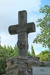
The cross of 1657 | |
 Camplong | |
|
Location within Occitanie region  Camplong | |
| Coordinates: 43°40′25″N 3°07′09″E / 43.6736°N 3.1192°ECoordinates: 43°40′25″N 3°07′09″E / 43.6736°N 3.1192°E | |
| Country | France |
| Region | Occitanie |
| Department | Hérault |
| Arrondissement | Béziers |
| Canton | Bédarieux |
| Intercommunality | Monts d'Orb |
| Government | |
| • Mayor (2008–2014) | Bernard Coste |
| Area1 | 13.25 km2 (5.12 sq mi) |
| Population (2008)2 | 236 |
| • Density | 18/km2 (46/sq mi) |
| Time zone | CET (UTC+1) |
| • Summer (DST) | CEST (UTC+2) |
| INSEE/Postal code | 34049 / 34260 |
| Elevation |
264–882 m (866–2,894 ft) (avg. 247 m or 810 ft) |
|
1 French Land Register data, which excludes lakes, ponds, glaciers > 1 km² (0.386 sq mi or 247 acres) and river estuaries. 2 Population without double counting: residents of multiple communes (e.g., students and military personnel) only counted once. | |
Camplong is a commune in the Hérault department in southern France.
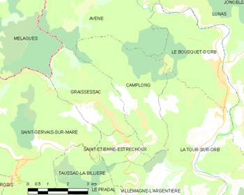
Map
Population
| Historical population | ||
|---|---|---|
| Year | Pop. | ±% |
| 1881 | 1,685 | — |
| 1891 | 1,902 | +12.9% |
| 1901 | 600 | −68.5% |
| 1911 | 574 | −4.3% |
| 1921 | 546 | −4.9% |
| 1931 | 614 | +12.5% |
| 1936 | 596 | −2.9% |
| 1954 | 615 | +3.2% |
| 1962 | 182 | −70.4% |
| 1968 | 348 | +91.2% |
| 1975 | 305 | −12.4% |
| 1982 | 251 | −17.7% |
| 1990 | 241 | −4.0% |
| 1999 | 187 | −22.4% |
| 2008 | 236 | +26.2% |
See also
References
| Wikimedia Commons has media related to Camplong (Hérault). |
This article is issued from Wikipedia - version of the 6/24/2015. The text is available under the Creative Commons Attribution/Share Alike but additional terms may apply for the media files.