Fraisse-sur-Agout
| Fraisse-sur-Agout | ||
|---|---|---|
|
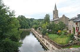
The Agout, the village and the bell tower of Saint-Jean-Baptiste | ||
| ||
 Fraisse-sur-Agout | ||
|
Location within Occitanie region  Fraisse-sur-Agout | ||
| Coordinates: 43°36′25″N 2°47′54″E / 43.6069°N 2.7983°ECoordinates: 43°36′25″N 2°47′54″E / 43.6069°N 2.7983°E | ||
| Country | France | |
| Region | Occitanie | |
| Department | Hérault | |
| Arrondissement | Béziers | |
| Canton | La Salvetat-sur-Agout | |
| Intercommunality | Montagne du Haut Languedoc | |
| Government | ||
| • Mayor (2008–2014) | Marguerite Mathieu | |
| Area1 | 58.46 km2 (22.57 sq mi) | |
| Population (2008)2 | 352 | |
| • Density | 6.0/km2 (16/sq mi) | |
| Time zone | CET (UTC+1) | |
| • Summer (DST) | CEST (UTC+2) | |
| INSEE/Postal code | 34107 / 34330 | |
| Elevation |
435–1,111 m (1,427–3,645 ft) (avg. 700 m or 2,300 ft) | |
|
1 French Land Register data, which excludes lakes, ponds, glaciers > 1 km² (0.386 sq mi or 247 acres) and river estuaries. 2 Population without double counting: residents of multiple communes (e.g., students and military personnel) only counted once. | ||

Fraisse-sur-Agout is a commune in the Hérault department in southern France.
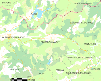
Map
Population
| Historical population | ||
|---|---|---|
| Year | Pop. | ±% |
| 1962 | 232 | — |
| 1968 | 294 | +26.7% |
| 1975 | 270 | −8.2% |
| 1982 | 266 | −1.5% |
| 1990 | 249 | −6.4% |
| 1999 | 322 | +29.3% |
| 2008 | 352 | +9.3% |
See also
References
| Wikimedia Commons has media related to Fraisse-sur-Agout. |
This article is issued from Wikipedia - version of the 3/15/2016. The text is available under the Creative Commons Attribution/Share Alike but additional terms may apply for the media files.