Cessenon-sur-Orb
| Cessenon-sur-Orb | ||
|---|---|---|
|
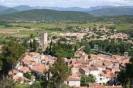
A general view of Cessenon-sur-Orb | ||
| ||
 Cessenon-sur-Orb | ||
|
Location within Occitanie region  Cessenon-sur-Orb | ||
| Coordinates: 43°27′03″N 3°03′07″E / 43.4508°N 3.0519°ECoordinates: 43°27′03″N 3°03′07″E / 43.4508°N 3.0519°E | ||
| Country | France | |
| Region | Occitanie | |
| Department | Hérault | |
| Arrondissement | Béziers | |
| Canton | Saint-Chinian | |
| Intercommunality | Saint-Chinianais | |
| Government | ||
| • Mayor (2008–2014) | Christian Francès | |
| Area1 | 37.29 km2 (14.40 sq mi) | |
| Population (2008)2 | 2,002 | |
| • Density | 54/km2 (140/sq mi) | |
| Time zone | CET (UTC+1) | |
| • Summer (DST) | CEST (UTC+2) | |
| INSEE/Postal code | 34074 / 34460 | |
| Elevation |
29–254 m (95–833 ft) (avg. 52 m or 171 ft) | |
|
1 French Land Register data, which excludes lakes, ponds, glaciers > 1 km² (0.386 sq mi or 247 acres) and river estuaries. 2 Population without double counting: residents of multiple communes (e.g., students and military personnel) only counted once. | ||
.svg.png)
Cessenon-sur-Orb is a commune in the Hérault department in southern France.
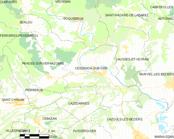
Map
Population
| Historical population | ||
|---|---|---|
| Year | Pop. | ±% |
| 1962 | 1,978 | — |
| 1968 | 2,025 | +2.4% |
| 1975 | 1,736 | −14.3% |
| 1982 | 1,680 | −3.2% |
| 1990 | 1,602 | −4.6% |
| 1999 | 1,734 | +8.2% |
| 2008 | 2,002 | +15.5% |
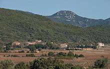
Hamlet of Lugné.
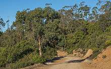
The Eucalyptus forest.
See also
References
External links
| Wikimedia Commons has media related to Cessenon-sur-Orb. |
This article is issued from Wikipedia - version of the 2/11/2016. The text is available under the Creative Commons Attribution/Share Alike but additional terms may apply for the media files.