La Caunette
| La Caunette | ||
|---|---|---|
|
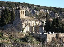
Church Notre Dame | ||
| ||
 La Caunette | ||
|
Location within Occitanie region  La Caunette | ||
| Coordinates: 43°21′13″N 2°46′49″E / 43.3536°N 2.7803°ECoordinates: 43°21′13″N 2°46′49″E / 43.3536°N 2.7803°E | ||
| Country | France | |
| Region | Occitanie | |
| Department | Hérault | |
| Arrondissement | Béziers | |
| Canton | Olonzac | |
| Intercommunality | Minervois | |
| Government | ||
| • Mayor (2008–2014) | Henri Poumayrac | |
| Area1 | 21.78 km2 (8.41 sq mi) | |
| Population (2008)2 | 325 | |
| • Density | 15/km2 (39/sq mi) | |
| Time zone | CET (UTC+1) | |
| • Summer (DST) | CEST (UTC+2) | |
| INSEE/Postal code | 34059 / 34210 | |
| Elevation |
112–483 m (367–1,585 ft) (avg. 128 m or 420 ft) | |
|
1 French Land Register data, which excludes lakes, ponds, glaciers > 1 km² (0.386 sq mi or 247 acres) and river estuaries. 2 Population without double counting: residents of multiple communes (e.g., students and military personnel) only counted once. | ||
.svg.png)
La Caunette is a commune in the Hérault department in southern France.
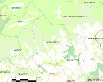
Map
Population
| Historical population | ||
|---|---|---|
| Year | Pop. | ±% |
| 1962 | 340 | — |
| 1968 | 360 | +5.9% |
| 1975 | 311 | −13.6% |
| 1982 | 265 | −14.8% |
| 1990 | 293 | +10.6% |
| 1999 | 306 | +4.4% |
| 2008 | 325 | +6.2% |
See also
References
| Wikimedia Commons has media related to La Caunette. |
This article is issued from Wikipedia - version of the 2/12/2016. The text is available under the Creative Commons Attribution/Share Alike but additional terms may apply for the media files.