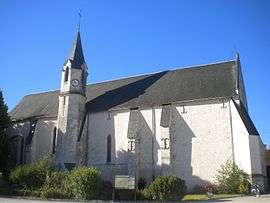
Courmemin
| Courmemin | |
|---|---|
 | |
 Courmemin | |
|
Location within Centre-Val de Loire region 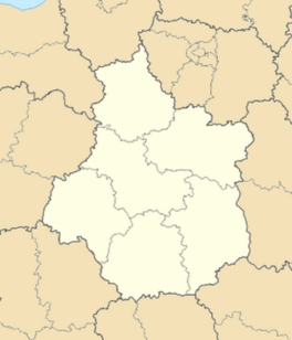 Courmemin | |
| Coordinates: 47°28′22″N 1°37′41″E / 47.4728°N 1.6281°ECoordinates: 47°28′22″N 1°37′41″E / 47.4728°N 1.6281°E | |
| Country | France |
| Region | Centre-Val de Loire |
| Department | Loir-et-Cher |
| Arrondissement | Romorantin-Lanthenay |
| Canton | Romorantin-Lanthenay-Nord |
| Government | |
| • Mayor (2014–2020) | Gilles Chantier |
| Area1 | 24.17 km2 (9.33 sq mi) |
| Population (2013)2 | 519 |
| • Density | 21/km2 (56/sq mi) |
| Time zone | CET (UTC+1) |
| • Summer (DST) | CEST (UTC+2) |
| INSEE/Postal code | 41068 / 41230 |
| Elevation |
84–124 m (276–407 ft) (avg. 110 m or 360 ft) |
|
1 French Land Register data, which excludes lakes, ponds, glaciers > 1 km² (0.386 sq mi or 247 acres) and river estuaries. 2 Population without double counting: residents of multiple communes (e.g., students and military personnel) only counted once. | |
Courmemin is a commune in the Loir-et-Cher department of central France.
Population
| Historical population | ||
|---|---|---|
| Year | Pop. | ±% |
| 1793 | 443 | — |
| 1806 | 406 | −8.4% |
| 1821 | 448 | +10.3% |
| 1831 | 509 | +13.6% |
| 1841 | 503 | −1.2% |
| 1851 | 544 | +8.2% |
| 1861 | 514 | −5.5% |
| 1872 | 603 | +17.3% |
| 1881 | 602 | −0.2% |
| 1891 | 670 | +11.3% |
| 1901 | 778 | +16.1% |
| 1911 | 756 | −2.8% |
| 1921 | 677 | −10.4% |
| 1931 | 662 | −2.2% |
| 1946 | 619 | −6.5% |
| 1954 | 615 | −0.6% |
| 1962 | 603 | −2.0% |
| 1968 | 588 | −2.5% |
| 1975 | 505 | −14.1% |
| 1982 | 503 | −0.4% |
| 1990 | 526 | +4.6% |
| 1999 | 471 | −10.5% |
| 2008 | 521 | +10.6% |
| 2013 | 519 | −0.4% |
See also
References
| Wikimedia Commons has media related to Courmemin. |
This article is issued from Wikipedia - version of the 11/15/2016. The text is available under the Creative Commons Attribution/Share Alike but additional terms may apply for the media files.