Épiais
| Épiais | ||
|---|---|---|
|
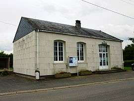
Town hall | ||
| ||
 Épiais | ||
|
Location within Centre-Val de Loire region  Épiais | ||
| Coordinates: 47°48′29″N 1°15′08″E / 47.8081°N 1.2522°ECoordinates: 47°48′29″N 1°15′08″E / 47.8081°N 1.2522°E | ||
| Country | France | |
| Region | Centre-Val de Loire | |
| Department | Loir-et-Cher | |
| Arrondissement | Vendôme | |
| Canton | Selommes | |
| Intercommunality | Beauce et Forêt | |
| Government | ||
| • Mayor (2014– 2020) | Michel Peignant | |
| Area1 | 8.7 km2 (3.4 sq mi) | |
| Population (2013)2 | 147 | |
| • Density | 17/km2 (44/sq mi) | |
| Time zone | CET (UTC+1) | |
| • Summer (DST) | CEST (UTC+2) | |
| INSEE/Postal code | 41077 / 41290 | |
| Elevation | 108–136 m (354–446 ft) | |
|
1 French Land Register data, which excludes lakes, ponds, glaciers > 1 km² (0.386 sq mi or 247 acres) and river estuaries. 2 Population without double counting: residents of multiple communes (e.g., students and military personnel) only counted once. | ||
.svg.png)
Épiais is a commune in the Loir-et-Cher department of central France.
Population
| Historical population | ||
|---|---|---|
| Year | Pop. | ±% |
| 1793 | 122 | — |
| 1806 | 140 | +14.8% |
| 1821 | 150 | +7.1% |
| 1831 | 160 | +6.7% |
| 1841 | 172 | +7.5% |
| 1951 | 208 | +20.9% |
| 1861 | 213 | +2.4% |
| 1872 | 189 | −11.3% |
| 1881 | 207 | +9.5% |
| 1891 | 267 | +29.0% |
| 1901 | 252 | −5.6% |
| 1911 | 242 | −4.0% |
| 1921 | 210 | −13.2% |
| 1931 | 179 | −14.8% |
| 1946 | 128 | −28.5% |
| 1954 | 175 | +36.7% |
| 1962 | 186 | +6.3% |
| 1968 | 185 | −0.5% |
| 1975 | 153 | −17.3% |
| 1982 | 121 | −20.9% |
| 1990 | 87 | −28.1% |
| 1999 | 94 | +8.0% |
| 2008 | 124 | +31.9% |
| 2013 | 147 | +18.5% |
See also
References
| Wikimedia Commons has media related to Épiais. |
This article is issued from Wikipedia - version of the 11/23/2016. The text is available under the Creative Commons Attribution/Share Alike but additional terms may apply for the media files.