Inguiniel
| Inguiniel An Ignel | |
|---|---|
|
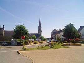
A view within Inguiniel | |
 Inguiniel | |
|
Location within Brittany region 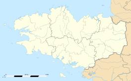 Inguiniel | |
| Coordinates: 47°58′37″N 3°16′54″W / 47.9769°N 3.2817°WCoordinates: 47°58′37″N 3°16′54″W / 47.9769°N 3.2817°W | |
| Country | France |
| Region | Brittany |
| Department | Morbihan |
| Arrondissement | Lorient |
| Canton | Plouay |
| Intercommunality | Région de Plouay |
| Government | |
| • Mayor (2008—2014) | Jean-Louis Le Masle |
| Area1 | 51.40 km2 (19.85 sq mi) |
| Population (1999)2 | 1,890 |
| • Density | 37/km2 (95/sq mi) |
| Time zone | CET (UTC+1) |
| • Summer (DST) | CEST (UTC+2) |
| INSEE/Postal code | 56089 / 56240 |
| Elevation | 49–171 m (161–561 ft) |
|
1 French Land Register data, which excludes lakes, ponds, glaciers > 1 km² (0.386 sq mi or 247 acres) and river estuaries. 2 Population without double counting: residents of multiple communes (e.g., students and military personnel) only counted once. | |
Inguiniel (Breton: An Ignel) is a commune in the Morbihan department in Brittany in north-western France.
Demographics
Inhabitants of Inguiniel are called in French Inguinielois.
See also
References
External links
| Wikimedia Commons has media related to Inguiniel. |
- Service animation Enfance Jeunessede la Mairie d'Inguiniel (French)
- Cultural Heritage (French)
- Map of Inguiniel on Michelin (English)
This article is issued from Wikipedia - version of the 5/28/2015. The text is available under the Creative Commons Attribution/Share Alike but additional terms may apply for the media files.