Surzur
| Surzur Surzhur | ||
|---|---|---|
| ||
 Surzur | ||
|
Location within Brittany region 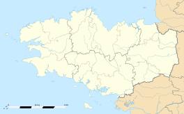 Surzur | ||
| Coordinates: 47°34′44″N 2°37′43″W / 47.5789°N 2.6286°WCoordinates: 47°34′44″N 2°37′43″W / 47.5789°N 2.6286°W | ||
| Country | France | |
| Region | Brittany | |
| Department | Morbihan | |
| Arrondissement | Vannes | |
| Canton | Vannes-Est | |
| Intercommunality | Pays de Vannes | |
| Government | ||
| • Mayor (2008—2014) | Marcel Le Nevé | |
| Area1 | 57.29 km2 (22.12 sq mi) | |
| Population (1999)2 | 2,434 | |
| • Density | 42/km2 (110/sq mi) | |
| Time zone | CET (UTC+1) | |
| • Summer (DST) | CEST (UTC+2) | |
| INSEE/Postal code | 56248 / 56450 | |
| Elevation | 0–42 m (0–138 ft) | |
|
1 French Land Register data, which excludes lakes, ponds, glaciers > 1 km² (0.386 sq mi or 247 acres) and river estuaries. 2 Population without double counting: residents of multiple communes (e.g., students and military personnel) only counted once. | ||
.svg.png)
Surzur (Breton: Surzhur) is a commune in the Morbihan department of Brittany, in north-western France.
Demographics
Inhabitants of Surzur are called in French Surzurois.
| Year | 1962 | 1968 | 1975 | 1982 | 1990 | 1999 | 2006 |
|---|---|---|---|---|---|---|---|
| Population | 1 492 | 1 461 | 1 452 | 1 658 | 2 081 | 2 434 | 3 491 |
| From the year 1962 on: No double counting—residents of multiple communes (e.g. students and military personnel) are counted only once. | |||||||
Breton language
In 2008, there was 11,42% of the children attended the bilingual schools in primary education.[1]
See also
References
- ↑ (French) Ofis ar Brezhoneg: Enseignement bilingue
External links
| Wikimedia Commons has media related to Surzur. |
- French Ministry of Culture list for Surzur (French)
- Map of Surzur on Michelin (English)
This article is issued from Wikipedia - version of the 2/13/2015. The text is available under the Creative Commons Attribution/Share Alike but additional terms may apply for the media files.