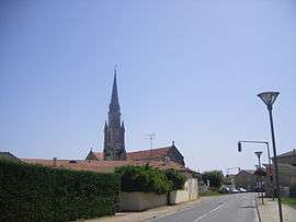
Le Barp
| Le Barp | ||
|---|---|---|
 | ||
| ||
 Le Barp | ||
|
Location within Nouvelle-Aquitaine region  Le Barp | ||
| Coordinates: 44°36′25″N 0°46′00″W / 44.6069°N 0.7667°WCoordinates: 44°36′25″N 0°46′00″W / 44.6069°N 0.7667°W | ||
| Country | France | |
| Region | Nouvelle-Aquitaine | |
| Department | Gironde | |
| Arrondissement | Arcachon | |
| Canton | Belin-Béliet | |
| Intercommunality | Val de l'Eyre | |
| Government | ||
| • Mayor (2008–2014) | Christiane Dornon | |
| Area1 | 107.32 km2 (41.44 sq mi) | |
| Population (2008)2 | 4,448 | |
| • Density | 41/km2 (110/sq mi) | |
| Time zone | CET (UTC+1) | |
| • Summer (DST) | CEST (UTC+2) | |
| INSEE/Postal code | 33029 / 33114 | |
| Elevation |
40–84 m (131–276 ft) (avg. 72 m or 236 ft) | |
|
1 French Land Register data, which excludes lakes, ponds, glaciers > 1 km² (0.386 sq mi or 247 acres) and river estuaries. 2 Population without double counting: residents of multiple communes (e.g., students and military personnel) only counted once. | ||
.svg.png)
Le Barp is a commune in the Gironde department in southwestern France.
Population
| Historical population | ||
|---|---|---|
| Year | Pop. | ±% |
| 1962 | 892 | — |
| 1968 | 958 | +7.4% |
| 1975 | 1,303 | +36.0% |
| 1982 | 2,238 | +71.8% |
| 1990 | 2,584 | +15.5% |
| 1999 | 3,242 | +25.5% |
| 2008 | 4,448 | +37.2% |
See also
References
| Wikimedia Commons has media related to Le Barp. |
This article is issued from Wikipedia - version of the 2/11/2016. The text is available under the Creative Commons Attribution/Share Alike but additional terms may apply for the media files.