Haux, Gironde
| Haux | ||
|---|---|---|
 | ||
| ||
 Haux | ||
|
Location within Nouvelle-Aquitaine region  Haux | ||
| Coordinates: 44°44′13″N 0°22′15″W / 44.7369°N 0.3708°WCoordinates: 44°44′13″N 0°22′15″W / 44.7369°N 0.3708°W | ||
| Country | France | |
| Region | Nouvelle-Aquitaine | |
| Department | Gironde | |
| Arrondissement | Bordeaux | |
| Canton | Créon | |
| Intercommunality | Créonnais | |
| Government | ||
| • Mayor (2008–2014) | Bernard Le Gorec | |
| Area1 | 10.21 km2 (3.94 sq mi) | |
| Population (2008)2 | 771 | |
| • Density | 76/km2 (200/sq mi) | |
| Time zone | CET (UTC+1) | |
| • Summer (DST) | CEST (UTC+2) | |
| INSEE/Postal code | 33201 / 33550 | |
| Elevation |
11–101 m (36–331 ft) (avg. 100 m or 330 ft) | |
|
1 French Land Register data, which excludes lakes, ponds, glaciers > 1 km² (0.386 sq mi or 247 acres) and river estuaries. 2 Population without double counting: residents of multiple communes (e.g., students and military personnel) only counted once. | ||
.svg.png)
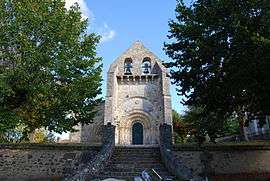
Haux (Occitan: Hauç) is a commune situated in the Gironde department in southwestern France.
Population
| Historical population | ||
|---|---|---|
| Year | Pop. | ±% |
| 1962 | 493 | — |
| 1968 | 552 | +12.0% |
| 1975 | 504 | −8.7% |
| 1982 | 647 | +28.4% |
| 1990 | 729 | +12.7% |
| 1999 | 732 | +0.4% |
| 2008 | 771 | +5.3% |
See also
References
| Wikimedia Commons has media related to Haux (Gironde). |
This article is issued from Wikipedia - version of the 4/24/2014. The text is available under the Creative Commons Attribution/Share Alike but additional terms may apply for the media files.