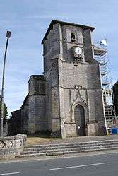
Nérigean
| Nérigean | |
|---|---|
 | |
 Nérigean | |
|
Location within Nouvelle-Aquitaine region  Nérigean | |
| Coordinates: 44°50′32″N 0°17′17″W / 44.8422°N 0.2881°WCoordinates: 44°50′32″N 0°17′17″W / 44.8422°N 0.2881°W | |
| Country | France |
| Region | Nouvelle-Aquitaine |
| Department | Gironde |
| Arrondissement | Libourne |
| Canton | Branne |
| Intercommunality | Entre Deux Mers Ouest |
| Government | |
| • Mayor (2008–2014) | Jean-Luc Lamaison |
| Area1 | 9.98 km2 (3.85 sq mi) |
| Population (2008)2 | 874 |
| • Density | 88/km2 (230/sq mi) |
| Time zone | CET (UTC+1) |
| • Summer (DST) | CEST (UTC+2) |
| INSEE/Postal code | 33303 / 33750 |
| Elevation |
8–76 m (26–249 ft) (avg. 70 m or 230 ft) |
|
1 French Land Register data, which excludes lakes, ponds, glaciers > 1 km² (0.386 sq mi or 247 acres) and river estuaries. 2 Population without double counting: residents of multiple communes (e.g., students and military personnel) only counted once. | |
Nérigean is a commune in the Gironde department in Nouvelle-Aquitaine in southwestern France.
Population
| Historical population | ||
|---|---|---|
| Year | Pop. | ±% |
| 1962 | 545 | — |
| 1968 | 560 | +2.8% |
| 1975 | 654 | +16.8% |
| 1982 | 948 | +45.0% |
| 1990 | 1,036 | +9.3% |
| 1999 | 880 | −15.1% |
| 2008 | 874 | −0.7% |
See also
References
| Wikimedia Commons has media related to Nérigean. |
This article is issued from Wikipedia - version of the 11/9/2016. The text is available under the Creative Commons Attribution/Share Alike but additional terms may apply for the media files.