Le Thil
| Le Thil | ||
|---|---|---|
| ||
 Le Thil | ||
|
Location within Normandy region 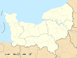 Le Thil | ||
| Coordinates: 49°18′43″N 1°33′25″E / 49.3119°N 1.5569°ECoordinates: 49°18′43″N 1°33′25″E / 49.3119°N 1.5569°E | ||
| Country | France | |
| Region | Normandy | |
| Department | Eure | |
| Arrondissement | Les Andelys | |
| Canton | Étrépagny | |
| Intercommunality | Canton d'Étrépagny | |
| Government | ||
| • Mayor (2008–2014) | Bernard Personnat | |
| Area1 | 4.24 km2 (1.64 sq mi) | |
| Population (2008)2 | 406 | |
| • Density | 96/km2 (250/sq mi) | |
| Time zone | CET (UTC+1) | |
| • Summer (DST) | CEST (UTC+2) | |
| INSEE/Postal code | 27632 / 27150 | |
| Elevation |
94–122 m (308–400 ft) (avg. 114 m or 374 ft) | |
|
1 French Land Register data, which excludes lakes, ponds, glaciers > 1 km² (0.386 sq mi or 247 acres) and river estuaries. 2 Population without double counting: residents of multiple communes (e.g., students and military personnel) only counted once. | ||
.svg.png)
Le Thil (also known as Le Thil-en-Vexin) is a commune in the Eure department in Haute-Normandie in northern France.
Population
| Historical population | ||
|---|---|---|
| Year | Pop. | ±% |
| 1962 | 274 | — |
| 1968 | 294 | +7.3% |
| 1975 | 246 | −16.3% |
| 1982 | 215 | −12.6% |
| 1990 | 199 | −7.4% |
| 1999 | 308 | +54.8% |
| 2008 | 406 | +31.8% |
See also
References
| Wikimedia Commons has media related to Le Thil. |
This article is issued from Wikipedia - version of the 3/15/2016. The text is available under the Creative Commons Attribution/Share Alike but additional terms may apply for the media files.