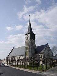
Routot
| Routot | ||
|---|---|---|
 | ||
| ||
 Routot | ||
|
Location within Normandy region 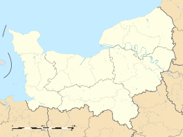 Routot | ||
| Coordinates: 49°22′44″N 0°44′08″E / 49.3789°N 0.7356°ECoordinates: 49°22′44″N 0°44′08″E / 49.3789°N 0.7356°E | ||
| Country | France | |
| Region | Normandy | |
| Department | Eure | |
| Arrondissement | Bernay | |
| Canton | Routot | |
| Intercommunality | Roumois Nord | |
| Government | ||
| • Mayor (2008–2014) | Bernard Vincent | |
| Area1 | 6.61 km2 (2.55 sq mi) | |
| Population (2008)2 | 1,353 | |
| • Density | 200/km2 (530/sq mi) | |
| Time zone | CET (UTC+1) | |
| • Summer (DST) | CEST (UTC+2) | |
| INSEE/Postal code | 27500 / 27350 | |
| Elevation |
91–142 m (299–466 ft) (avg. 140 m or 460 ft) | |
|
1 French Land Register data, which excludes lakes, ponds, glaciers > 1 km² (0.386 sq mi or 247 acres) and river estuaries. 2 Population without double counting: residents of multiple communes (e.g., students and military personnel) only counted once. | ||
.svg.png)
Routot is a commune in the Eure department in northern France.
Population
| Historical population | ||
|---|---|---|
| Year | Pop. | ±% |
| 1962 | 826 | — |
| 1968 | 882 | +6.8% |
| 1975 | 988 | +12.0% |
| 1982 | 1,079 | +9.2% |
| 1990 | 1,043 | −3.3% |
| 1999 | 1,115 | +6.9% |
| 2008 | 1,353 | +21.3% |
See also
References
| Wikimedia Commons has media related to Routot. |
This article is issued from Wikipedia - version of the 2/11/2016. The text is available under the Creative Commons Attribution/Share Alike but additional terms may apply for the media files.