Merck-Saint-Liévin
| Merck-Saint-Liévin | |
|---|---|
|
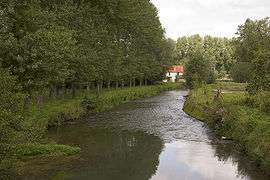
Aa river | |
 Merck-Saint-Liévin | |
|
Location within Hauts-de-France region  Merck-Saint-Liévin | |
| Coordinates: 50°37′40″N 2°06′55″E / 50.6278°N 2.1153°ECoordinates: 50°37′40″N 2°06′55″E / 50.6278°N 2.1153°E | |
| Country | France |
| Region | Hauts-de-France |
| Department | Pas-de-Calais |
| Arrondissement | Saint-Omer |
| Canton | Fauquembergues |
| Intercommunality | Communauté de communes du Canton de Fauquembergues |
| Government | |
| • Mayor | Francis Dhalleine |
| Area1 | 11.85 km2 (4.58 sq mi) |
| Population (2006)2 | 569 |
| • Density | 48/km2 (120/sq mi) |
| Time zone | CET (UTC+1) |
| • Summer (DST) | CEST (UTC+2) |
| INSEE/Postal code | 62569 / 62560 |
| Elevation |
56–172 m (184–564 ft) (avg. 68 m or 223 ft) |
|
1 French Land Register data, which excludes lakes, ponds, glaciers > 1 km² (0.386 sq mi or 247 acres) and river estuaries. 2 Population without double counting: residents of multiple communes (e.g., students and military personnel) only counted once. | |
Merck-Saint-Liévin is a commune in the Pas-de-Calais department in the Hauts-de-France region of France.
Geography
Merck-Saint-Liévin lies about 10 miles (16 km) southwest of Saint-Omer, on the D225 roads. The river Aa flows through the village.
Population
| 1962 | 1968 | 1975 | 1982 | 1990 | 1999 | 2006 |
|---|---|---|---|---|---|---|
| 535 | 550 | 547 | 514 | 517 | 507 | 569 |
| Census count starting from 1962: Population without duplicates | ||||||
Places of interest
- An eighteenth-century mill.
- The church of St. Omer, dating from the seventeenth century
See also
References
External links
| Wikimedia Commons has media related to Merck-Saint-Liévin. |
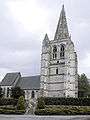 View from the south
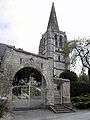 Cemetery gate
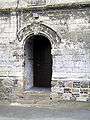 The side entrance
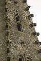 Features on the spire
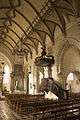 The nave
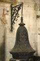 The font
This article is issued from Wikipedia - version of the 11/6/2016. The text is available under the Creative Commons Attribution/Share Alike but additional terms may apply for the media files.