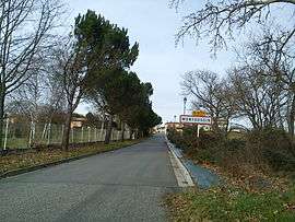
Montoussin
| Montoussin | |
|---|---|
 | |
 Montoussin | |
|
Location within Occitanie region  Montoussin | |
| Coordinates: 43°16′36″N 1°00′43″E / 43.2767°N 1.0119°ECoordinates: 43°16′36″N 1°00′43″E / 43.2767°N 1.0119°E | |
| Country | France |
| Region | Occitanie |
| Department | Haute-Garonne |
| Arrondissement | Muret |
| Canton | Fousseret |
| Intercommunality | Louge et le Touch |
| Government | |
| • Mayor (2008–2014) | Éliane de Min |
| Area1 | 4.83 km2 (1.86 sq mi) |
| Population (2008)2 | 114 |
| • Density | 24/km2 (61/sq mi) |
| Time zone | CET (UTC+1) |
| • Summer (DST) | CEST (UTC+2) |
| INSEE/Postal code | 31387 / 31430 |
| Elevation |
254–360 m (833–1,181 ft) (avg. 285 m or 935 ft) |
|
1 French Land Register data, which excludes lakes, ponds, glaciers > 1 km² (0.386 sq mi or 247 acres) and river estuaries. 2 Population without double counting: residents of multiple communes (e.g., students and military personnel) only counted once. | |
Montoussin is a commune in the Haute-Garonne department of southwestern France.
Population
| Historical population | ||
|---|---|---|
| Year | Pop. | ±% |
| 1962 | 78 | — |
| 1968 | 97 | +24.4% |
| 1975 | 89 | −8.2% |
| 1982 | 91 | +2.2% |
| 1990 | 108 | +18.7% |
| 1999 | 90 | −16.7% |
| 2008 | 114 | +26.7% |
See also
References
| Wikimedia Commons has media related to Montoussin. |
This article is issued from Wikipedia - version of the 4/1/2014. The text is available under the Creative Commons Attribution/Share Alike but additional terms may apply for the media files.