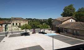
Montrabé
| Montrabé | ||
|---|---|---|
 | ||
| ||
 Montrabé | ||
|
Location within Occitanie region  Montrabé | ||
| Coordinates: 43°38′36″N 1°31′33″E / 43.6433°N 1.5258°ECoordinates: 43°38′36″N 1°31′33″E / 43.6433°N 1.5258°E | ||
| Country | France | |
| Region | Occitanie | |
| Department | Haute-Garonne | |
| Arrondissement | Toulouse | |
| Canton | Toulouse-8 | |
| Intercommunality | Dène Codene | |
| Government | ||
| • Mayor (2008–2014) | Jacques Sébi | |
| Area1 | 5.23 km2 (2.02 sq mi) | |
| Population (2008)2 | 3,368 | |
| • Density | 640/km2 (1,700/sq mi) | |
| Time zone | CET (UTC+1) | |
| • Summer (DST) | CEST (UTC+2) | |
| INSEE/Postal code | 31389 / 31850 | |
| Elevation |
143–211 m (469–692 ft) (avg. 150 m or 490 ft) | |
|
1 French Land Register data, which excludes lakes, ponds, glaciers > 1 km² (0.386 sq mi or 247 acres) and river estuaries. 2 Population without double counting: residents of multiple communes (e.g., students and military personnel) only counted once. | ||
.svg.png)
Montrabé is a commune in the Haute-Garonne department of southwestern France.
Population
| Historical population | ||
|---|---|---|
| Year | Pop. | ±% |
| 1962 | 286 | — |
| 1968 | 353 | +23.4% |
| 1975 | 821 | +132.6% |
| 1982 | 1,740 | +111.9% |
| 1990 | 2,347 | +34.9% |
| 1999 | 3,201 | +36.4% |
| 2008 | 3,368 | +5.2% |
Monuments
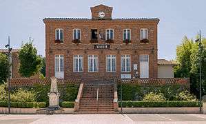 Town hall
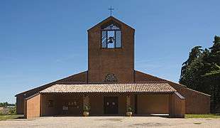 St-Martial church
See also
References
| Wikimedia Commons has media related to Montrabé. |
This article is issued from Wikipedia - version of the 9/27/2015. The text is available under the Creative Commons Attribution/Share Alike but additional terms may apply for the media files.