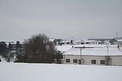
Slavičky
| Slavičky | |
|---|---|
| Municipality | |
 | |
 Slavičky | |
| Coordinates: 49°10′33″N 15°58′3″E / 49.17583°N 15.96750°ECoordinates: 49°10′33″N 15°58′3″E / 49.17583°N 15.96750°E | |
| Country |
|
| Region | Vysočina |
| District | Třebíč |
| Area | |
| • Total | 9.05 km2 (3.49 sq mi) |
| Elevation | 490 m (1,610 ft) |
| Population (2006) | |
| • Total | 224 |
| • Density | 25/km2 (64/sq mi) |
| Postal code | 675 01 |
| Website | http://www.slavicky.cz |
Slavičky is a village and municipality (obec) in Třebíč District in the Vysočina Region of the Czech Republic.
The municipality covers an area of 9.05 square kilometres (3.49 sq mi), and has a population of 224 (as of 3 July 2006).
Slavičky lies approximately 9 kilometres (6 mi) south-east of Třebíč, 37 km (23 mi) south-east of Jihlava, and 151 km (94 mi) south-east of Prague.
References
| Wikimedia Commons has media related to Slavičky. |
This article is issued from Wikipedia - version of the 4/7/2016. The text is available under the Creative Commons Attribution/Share Alike but additional terms may apply for the media files.