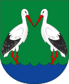
Výčapy
| Výčapy | |||
|---|---|---|---|
| Municipality | |||
 | |||
| |||
 Výčapy | |||
| Coordinates: 49°8′36″N 15°52′39″E / 49.14333°N 15.87750°ECoordinates: 49°8′36″N 15°52′39″E / 49.14333°N 15.87750°E | |||
| Country |
| ||
| Region | Vysočina | ||
| District | Třebíč | ||
| Area | |||
| • Total | 13.33 km2 (5.15 sq mi) | ||
| Elevation | 478 m (1,568 ft) | ||
| Population | |||
| • Total | 854 | ||
| • Density | 64/km2 (170/sq mi) | ||
| Postal code | 674 01 | ||
| Website | http://www.vycapy.cz | ||

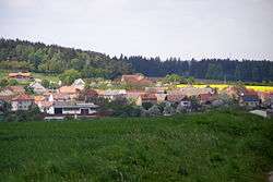
Výčapy is a village and municipality (obec) in Třebíč District in the Vysočina Region of the Czech Republic.
The municipality covers an area of 13.33 square kilometres (5.15 sq mi), and has a population of 854.
Výčapy lies approximately 9 kilometres (6 mi) south of Třebíč, 35 km (22 mi) south-east of Jihlava, and 149 km (93 mi) south-east of Prague.
References
| Wikimedia Commons has media related to Výčapy. |
This article is issued from Wikipedia - version of the 4/7/2016. The text is available under the Creative Commons Attribution/Share Alike but additional terms may apply for the media files.