Boisgervilly
| Boisgervilly Koad-Yarnvili | |
|---|---|
|
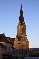
The church of Boisgervilly | |
 Boisgervilly | |
|
Location within Brittany region 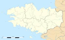 Boisgervilly | |
| Coordinates: 48°10′04″N 2°03′46″W / 48.1678°N 2.0628°WCoordinates: 48°10′04″N 2°03′46″W / 48.1678°N 2.0628°W | |
| Country | France |
| Region | Brittany |
| Department | Ille-et-Vilaine |
| Arrondissement | Rennes |
| Canton | Montauban-de-Bretagne |
| Intercommunality | Pays de Montauban-de-Bretagne |
| Government | |
| • Mayor (2014–2020) | Bernard Piedvache |
| Area1 | 19.95 km2 (7.70 sq mi) |
| Population (2009)2 | 1,486 |
| • Density | 74/km2 (190/sq mi) |
| Time zone | CET (UTC+1) |
| • Summer (DST) | CEST (UTC+2) |
| INSEE/Postal code | 35027 / 35360 |
| Elevation | 58–111 m (190–364 ft) |
|
1 French Land Register data, which excludes lakes, ponds, glaciers > 1 km² (0.386 sq mi or 247 acres) and river estuaries. 2 Population without double counting: residents of multiple communes (e.g., students and military personnel) only counted once. | |
Boisgervilly (Breton: Koad-Yarnvili, Gallo: Boéz-Jergaud) is a commune in the Ille-et-Vilaine department in Brittany in northwestern France.
Population
| Historical population | ||
|---|---|---|
| Year | Pop. | ±% |
| 1962 | 936 | — |
| 1968 | 936 | +0.0% |
| 1975 | 921 | −1.6% |
| 1982 | 1,074 | +16.6% |
| 1990 | 1,174 | +9.3% |
| 1999 | 1,215 | +3.5% |
| 2009 | 1,486 | +22.3% |
The inhabitants of Boisgervilly are known as Boisgervilliens in French.
Sights
The 19th-century church has an altar from the 17th century.
The chapel of St. Antoine was built in 1427.
See also
References
External links
| Wikimedia Commons has media related to Boisgervilly. |
- Official website (French)
- French Ministry of Culture list for Boisgervilly (French)
This article is issued from Wikipedia - version of the 11/5/2016. The text is available under the Creative Commons Attribution/Share Alike but additional terms may apply for the media files.