Le Rheu
| Le Rheu Reuz | ||
|---|---|---|
|
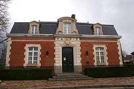
Town hall | ||
| ||
 Le Rheu | ||
|
Location within Brittany region 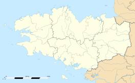 Le Rheu | ||
| Coordinates: 48°06′10″N 1°47′39″W / 48.1028°N 1.7942°WCoordinates: 48°06′10″N 1°47′39″W / 48.1028°N 1.7942°W | ||
| Country | France | |
| Region | Brittany | |
| Department | Ille-et-Vilaine | |
| Arrondissement | Rennes | |
| Canton | Mordelles | |
| Intercommunality | Rennes Métropole | |
| Government | ||
| • Mayor (2014–2020) | Jean-Luc Chenut | |
| Area1 | 18.89 km2 (7.29 sq mi) | |
| Population (2009)2 | 7,643 | |
| • Density | 400/km2 (1,000/sq mi) | |
| Time zone | CET (UTC+1) | |
| • Summer (DST) | CEST (UTC+2) | |
| INSEE/Postal code | 35240 / 35650 | |
| Elevation | 18–48 m (59–157 ft) | |
|
1 French Land Register data, which excludes lakes, ponds, glaciers > 1 km² (0.386 sq mi or 247 acres) and river estuaries. 2 Population without double counting: residents of multiple communes (e.g., students and military personnel) only counted once. | ||

Le Rheu (Breton: Reuz) is a commune in the Ille-et-Vilaine department in Brittany in northwestern France.
Population
Inhabitants of Le Rheu are called rheusois in French.
| Historical population | ||
|---|---|---|
| Year | Pop. | ±% |
| 1936 | 1,197 | — |
| 1954 | 1,273 | +6.3% |
| 1962 | 2,001 | +57.2% |
| 1968 | 3,080 | +53.9% |
| 1975 | 3,869 | +25.6% |
| 1982 | 4,276 | +10.5% |
| 1990 | 5,027 | +17.6% |
| 1999 | 5,733 | +14.0% |
| 2009 | 7,643 | +33.3% |
See also
References
External links
| Wikimedia Commons has media related to Le Rheu. |
- Official website (French)
- French Ministry of Culture list for Le Rheu (French)
This article is issued from Wikipedia - version of the 2/12/2016. The text is available under the Creative Commons Attribution/Share Alike but additional terms may apply for the media files.