Menet
| Menet | |
|---|---|
|
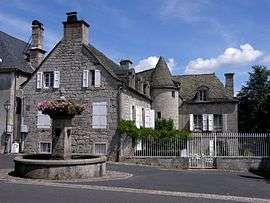
The fountain and a house in Menet | |
 Menet | |
|
Location within Auvergne-Rhône-Alpes region  Menet | |
| Coordinates: 45°17′51″N 2°35′03″E / 45.2975°N 2.5842°ECoordinates: 45°17′51″N 2°35′03″E / 45.2975°N 2.5842°E | |
| Country | France |
| Region | Auvergne-Rhône-Alpes |
| Department | Cantal |
| Arrondissement | Mauriac |
| Canton | Riom-ès-Montagnes |
| Intercommunality | Pays de Gentiane |
| Government | |
| • Mayor (2008–2014) | Alexis Monier |
| Area1 | 29.86 km2 (11.53 sq mi) |
| Population (2008)2 | 506 |
| • Density | 17/km2 (44/sq mi) |
| Time zone | CET (UTC+1) |
| • Summer (DST) | CEST (UTC+2) |
| INSEE/Postal code | 15124 / 15400 |
| Elevation |
579–980 m (1,900–3,215 ft) (avg. 715 m or 2,346 ft) |
|
1 French Land Register data, which excludes lakes, ponds, glaciers > 1 km² (0.386 sq mi or 247 acres) and river estuaries. 2 Population without double counting: residents of multiple communes (e.g., students and military personnel) only counted once. | |
Menet is a commune in the Cantal department in south-central France.
The village is noteworthy for its twelfth century Romanesque Church of St Peter, and for its small lake.
Population
| Historical population | ||
|---|---|---|
| Year | Pop. | ±% |
| 1962 | 851 | — |
| 1968 | 819 | −3.8% |
| 1975 | 653 | −20.3% |
| 1982 | 653 | +0.0% |
| 1990 | 622 | −4.7% |
| 1999 | 580 | −6.8% |
| 2008 | 506 | −12.8% |
See also
References
| Wikimedia Commons has media related to Menet. |
This article is issued from Wikipedia - version of the 3/15/2016. The text is available under the Creative Commons Attribution/Share Alike but additional terms may apply for the media files.