Besse, Cantal
| Besse | |
|---|---|
|
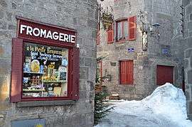
The cheese shop in Besse | |
 Besse | |
|
Location within Auvergne-Rhône-Alpes region  Besse | |
| Coordinates: 45°05′49″N 2°21′00″E / 45.0969°N 2.35°ECoordinates: 45°05′49″N 2°21′00″E / 45.0969°N 2.35°E | |
| Country | France |
| Region | Auvergne-Rhône-Alpes |
| Department | Cantal |
| Arrondissement | Aurillac |
| Canton | Saint-Cernin |
| Intercommunality | Pays de Salers |
| Government | |
| • Mayor (2008–2014) | Michel Fabre |
| Area1 | 3.77 km2 (1.46 sq mi) |
| Population (2008)2 | 132 |
| • Density | 35/km2 (91/sq mi) |
| Time zone | CET (UTC+1) |
| • Summer (DST) | CEST (UTC+2) |
| INSEE/Postal code | 15269 / 15140 |
| Elevation |
559–769 m (1,834–2,523 ft) (avg. 750 m or 2,460 ft) |
|
1 French Land Register data, which excludes lakes, ponds, glaciers > 1 km² (0.386 sq mi or 247 acres) and river estuaries. 2 Population without double counting: residents of multiple communes (e.g., students and military personnel) only counted once. | |
Besse is a commune in the Cantal department in south-central France.
Geography
The Maronne river forms the commune's northern border.
Population
| Historical population | ||
|---|---|---|
| Year | Pop. | ±% |
| 1962 | 193 | — |
| 1968 | 199 | +3.1% |
| 1975 | 176 | −11.6% |
| 1982 | 159 | −9.7% |
| 1990 | 153 | −3.8% |
| 1999 | 143 | −6.5% |
| 2008 | 132 | −7.7% |
See also
References
| Wikimedia Commons has media related to Besse (Cantal). |
This article is issued from Wikipedia - version of the 2/15/2015. The text is available under the Creative Commons Attribution/Share Alike but additional terms may apply for the media files.