Méallet
| Méallet | |
|---|---|
|
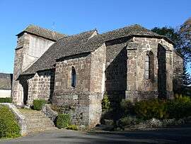
The church of Saint-Georges, in Méallet | |
 Méallet | |
|
Location within Auvergne-Rhône-Alpes region  Méallet | |
| Coordinates: 45°15′21″N 2°25′52″E / 45.2558°N 2.4311°ECoordinates: 45°15′21″N 2°25′52″E / 45.2558°N 2.4311°E | |
| Country | France |
| Region | Auvergne-Rhône-Alpes |
| Department | Cantal |
| Arrondissement | Mauriac |
| Canton | Mauriac |
| Intercommunality | Pays de Mauriac |
| Government | |
| • Mayor (2008–2014) | Colette Zevaco |
| Area1 | 21.52 km2 (8.31 sq mi) |
| Population (2008)2 | 173 |
| • Density | 8.0/km2 (21/sq mi) |
| Time zone | CET (UTC+1) |
| • Summer (DST) | CEST (UTC+2) |
| INSEE/Postal code | 15123 / 15200 |
| Elevation |
368–828 m (1,207–2,717 ft) (avg. 700 m or 2,300 ft) |
|
1 French Land Register data, which excludes lakes, ponds, glaciers > 1 km² (0.386 sq mi or 247 acres) and river estuaries. 2 Population without double counting: residents of multiple communes (e.g., students and military personnel) only counted once. | |
Méallet is a commune in the Cantal department in south-central France.
Population
| Historical population | ||
|---|---|---|
| Year | Pop. | ±% |
| 1901 | 876 | — |
| 1906 | 909 | +3.8% |
| 1911 | 869 | −4.4% |
| 1921 | 778 | −10.5% |
| 1926 | 784 | +0.8% |
| 1931 | 746 | −4.8% |
| 1936 | 704 | −5.6% |
| 1954 | 504 | −28.4% |
| 1962 | 435 | −13.7% |
| 1968 | 379 | −12.9% |
| 1975 | 304 | −19.8% |
| 1982 | 248 | −18.4% |
| 1990 | 185 | −25.4% |
| 1999 | 173 | −6.5% |
| 2008 | 173 | +0.0% |
See also
References
| Wikimedia Commons has media related to Méallet. |
This article is issued from Wikipedia - version of the 3/15/2016. The text is available under the Creative Commons Attribution/Share Alike but additional terms may apply for the media files.