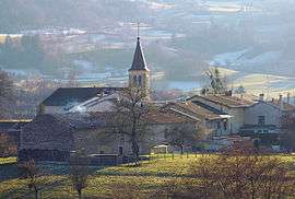
Cornod
| Cornod | |
|---|---|
 | |
 Cornod | |
|
Location within Bourgogne-Franche-Comté region  Cornod | |
| Coordinates: 46°18′51″N 5°32′58″E / 46.3142°N 5.5494°ECoordinates: 46°18′51″N 5°32′58″E / 46.3142°N 5.5494°E | |
| Country | France |
| Region | Bourgogne-Franche-Comté |
| Department | Jura |
| Arrondissement | Lons-le-Saunier |
| Canton | Arinthod |
| Government | |
| • Mayor (2014–2020) | Patrick Andrey |
| Area1 | 13.99 km2 (5.40 sq mi) |
| Population (2012)2 | 236 |
| • Density | 17/km2 (44/sq mi) |
| Time zone | CET (UTC+1) |
| • Summer (DST) | CEST (UTC+2) |
| INSEE/Postal code | 39166 / 39240 |
| Elevation | 305–680 m (1,001–2,231 ft) |
|
1 French Land Register data, which excludes lakes, ponds, glaciers > 1 km² (0.386 sq mi or 247 acres) and river estuaries. 2 Population without double counting: residents of multiple communes (e.g., students and military personnel) only counted once. | |
Cornod is a commune in the Jura department in Franche-Comté in eastern France.
Population
| Historical population | ||
|---|---|---|
| Year | Pop. | ±% |
| 1793 | 465 | — |
| 1806 | 479 | +3.0% |
| 1821 | 438 | −8.6% |
| 1831 | 750 | +71.2% |
| 1841 | 707 | −5.7% |
| 1851 | 675 | −4.5% |
| 1861 | 631 | −6.5% |
| 1872 | 646 | +2.4% |
| 1881 | 630 | −2.5% |
| 1891 | 570 | −9.5% |
| 1901 | 500 | −12.3% |
| 1911 | 408 | −18.4% |
| 1921 | 363 | −11.0% |
| 1931 | 332 | −8.5% |
| 1946 | 323 | −2.7% |
| 1954 | 265 | −18.0% |
| 1962 | 251 | −5.3% |
| 1968 | 223 | −11.2% |
| 1975 | 192 | −13.9% |
| 1982 | 189 | −1.6% |
| 1990 | 177 | −6.3% |
| 1999 | 219 | +23.7% |
| 2006 | 220 | +0.5% |
| 2012 | 236 | +7.3% |
See also
- Château de Cornod, a listed castle.
- Communes of the Jura department
References
| Wikimedia Commons has media related to Cornod. |
This article is issued from Wikipedia - version of the 5/25/2015. The text is available under the Creative Commons Attribution/Share Alike but additional terms may apply for the media files.