Les Piards
| Les Piards | |
|---|---|
 | |
 Les Piards | |
|
Location within Bourgogne-Franche-Comté region  Les Piards | |
| Coordinates: 46°29′47″N 5°49′46″E / 46.4964°N 5.8294°ECoordinates: 46°29′47″N 5°49′46″E / 46.4964°N 5.8294°E | |
| Country | France |
| Region | Bourgogne-Franche-Comté |
| Department | Jura |
| Arrondissement | Saint-Claude |
| Canton | Saint-Laurent-en-Grandvaux |
| Government | |
| • Mayor (2014–2020) | Fabien Morel |
| Area1 | 5.29 km2 (2.04 sq mi) |
| Population (2012)2 | 169 |
| • Density | 32/km2 (83/sq mi) |
| Time zone | CET (UTC+1) |
| • Summer (DST) | CEST (UTC+2) |
| INSEE/Postal code | 39417 / 39150 |
| Elevation | 884–1,030 m (2,900–3,379 ft) |
|
1 French Land Register data, which excludes lakes, ponds, glaciers > 1 km² (0.386 sq mi or 247 acres) and river estuaries. 2 Population without double counting: residents of multiple communes (e.g., students and military personnel) only counted once. | |
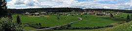
Les Piards is a commune in the Jura department in Franche-Comté in eastern France.
Population
| Historical population | ||
|---|---|---|
| Year | Pop. | ±% |
| 1793 | 171 | — |
| 1806 | 235 | +37.4% |
| 1821 | 232 | −1.3% |
| 1831 | 190 | −18.1% |
| 1841 | 166 | −12.6% |
| 1851 | 153 | −7.8% |
| 1861 | 153 | +0.0% |
| 1872 | 150 | −2.0% |
| 1881 | 138 | −8.0% |
| 1891 | 144 | +4.3% |
| 1901 | 156 | +8.3% |
| 1911 | 162 | +3.8% |
| 1921 | 147 | −9.3% |
| 1931 | 137 | −6.8% |
| 1946 | 134 | −2.2% |
| 1954 | 154 | +14.9% |
| 1962 | 130 | −15.6% |
| 1968 | 141 | +8.5% |
| 1975 | 132 | −6.4% |
| 1982 | 135 | +2.3% |
| 1990 | 132 | −2.2% |
| 1999 | 176 | +33.3% |
| 2006 | 179 | +1.7% |
| 2012 | 169 | −5.6% |
See also
References
| Wikimedia Commons has media related to Les Piards. |
This article is issued from Wikipedia - version of the 2/11/2016. The text is available under the Creative Commons Attribution/Share Alike but additional terms may apply for the media files.