Goux-sous-Landet
| Goux-sous-Landet | |
|---|---|
|
Goux-sous-Landet | |
 Goux-sous-Landet | |
|
Location within Bourgogne-Franche-Comté region  Goux-sous-Landet | |
| Coordinates: 47°04′52″N 5°56′03″E / 47.0811°N 5.9342°ECoordinates: 47°04′52″N 5°56′03″E / 47.0811°N 5.9342°E | |
| Country | France |
| Region | Bourgogne-Franche-Comté |
| Department | Doubs |
| Arrondissement | Besançon |
| Canton | Quingey |
| Government | |
| • Mayor (2008–2014) | Patricia Guyetant |
| Area1 | 5.42 km2 (2.09 sq mi) |
| Population (2012)2 | 66 |
| • Density | 12/km2 (32/sq mi) |
| Time zone | CET (UTC+1) |
| • Summer (DST) | CEST (UTC+2) |
| INSEE/Postal code | 25283 / 25440 |
| Elevation | 377–581 m (1,237–1,906 ft) |
|
1 French Land Register data, which excludes lakes, ponds, glaciers > 1 km² (0.386 sq mi or 247 acres) and river estuaries. 2 Population without double counting: residents of multiple communes (e.g., students and military personnel) only counted once. | |
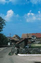
Goux-sous-Landet is a commune in the Doubs department in the Bourgogne-Franche-Comté region in eastern France.
It is located on the D110 route, south of Courcelles.
Population
| Historical population | ||
|---|---|---|
| Year | Pop. | ±% |
| 1962 | 46 | — |
| 1968 | 55 | +19.6% |
| 1975 | 54 | −1.8% |
| 1982 | 53 | −1.9% |
| 1990 | 56 | +5.7% |
| 1999 | 42 | −25.0% |
| 2008 | 49 | +16.7% |
| 2012 | 66 | +34.7% |
See also
References
| Wikimedia Commons has media related to Goux-sous-Landet. |
This article is issued from Wikipedia - version of the 10/29/2016. The text is available under the Creative Commons Attribution/Share Alike but additional terms may apply for the media files.