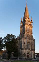
Doubs, Doubs
| Doubs | ||
|---|---|---|
 | ||
| ||
 Doubs | ||
|
Location within Bourgogne-Franche-Comté region  Doubs | ||
| Coordinates: 46°55′39″N 6°21′03″E / 46.9275°N 6.3508°ECoordinates: 46°55′39″N 6°21′03″E / 46.9275°N 6.3508°E | ||
| Country | France | |
| Region | Bourgogne-Franche-Comté | |
| Department | Doubs | |
| Arrondissement | Pontarlier | |
| Canton | Pontarlier | |
| Intercommunality | Larmont | |
| Government | ||
| • Mayor (2008–2014) | Régis Marceau | |
| Area1 | 8.94 km2 (3.45 sq mi) | |
| Population (2012)2 | 2,666 | |
| • Density | 300/km2 (770/sq mi) | |
| Time zone | CET (UTC+1) | |
| • Summer (DST) | CEST (UTC+2) | |
| INSEE/Postal code | 25204 / 25300 | |
| Elevation | 795–1,052 m (2,608–3,451 ft) | |
|
1 French Land Register data, which excludes lakes, ponds, glaciers > 1 km² (0.386 sq mi or 247 acres) and river estuaries. 2 Population without double counting: residents of multiple communes (e.g., students and military personnel) only counted once. | ||
.svg.png)
Doubs (French pronunciation: [du]) is a commune in the Doubs department in the Bourgogne-Franche-Comté region in eastern France.
Population
| Historical population | ||
|---|---|---|
| Year | Pop. | ±% |
| 1962 | 623 | — |
| 1968 | 789 | +26.6% |
| 1975 | 1,049 | +33.0% |
| 1982 | 1,267 | +20.8% |
| 1990 | 1,677 | +32.4% |
| 1999 | 2,266 | +35.1% |
| 2008 | 2,482 | +9.5% |
| 2012 | 2,666 | +7.4% |
See also
References
| Wikimedia Commons has media related to Doubs (Doubs). |
This article is issued from Wikipedia - version of the 10/29/2016. The text is available under the Creative Commons Attribution/Share Alike but additional terms may apply for the media files.