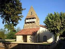
Garein
| Garein | |
|---|---|
 | |
 Garein | |
|
Location within Nouvelle-Aquitaine region  Garein | |
| Coordinates: 44°02′51″N 0°39′01″W / 44.0475°N 0.6503°WCoordinates: 44°02′51″N 0°39′01″W / 44.0475°N 0.6503°W | |
| Country | France |
| Region | Nouvelle-Aquitaine |
| Department | Landes |
| Arrondissement | Mont-de-Marsan |
| Canton | Labrit |
| Intercommunality | Pays d'Albret |
| Government | |
| • Mayor (2014–2020) | Philippe Sartre |
| Area1 | 57.1 km2 (22.0 sq mi) |
| Population (2013)2 | 442 |
| • Density | 7.7/km2 (20/sq mi) |
| Time zone | CET (UTC+1) |
| • Summer (DST) | CEST (UTC+2) |
| INSEE/Postal code | 40105 / 40420 |
| Elevation |
65–106 m (213–348 ft) (avg. 36 m or 118 ft) |
|
1 French Land Register data, which excludes lakes, ponds, glaciers > 1 km² (0.386 sq mi or 247 acres) and river estuaries. 2 Population without double counting: residents of multiple communes (e.g., students and military personnel) only counted once. | |
Garein is a commune in the Landes department in Nouvelle-Aquitaine in southwestern France.
Population
| Historical population | ||
|---|---|---|
| Year | Pop. | ±% |
| 1793 | 555 | — |
| 1806 | 662 | +19.3% |
| 1821 | 739 | +11.6% |
| 1831 | 753 | +1.9% |
| 1841 | 829 | +10.1% |
| 1851 | 859 | +3.6% |
| 1861 | 863 | +0.5% |
| 1872 | 840 | −2.7% |
| 1881 | 861 | +2.5% |
| 1891 | 770 | −10.6% |
| 1901 | 706 | −8.3% |
| 1911 | 728 | +3.1% |
| 1921 | 614 | −15.7% |
| 1931 | 549 | −10.6% |
| 1946 | 464 | −15.5% |
| 1954 | 457 | −1.5% |
| 1962 | 436 | −4.6% |
| 1968 | 401 | −8.0% |
| 1975 | 410 | +2.2% |
| 1982 | 385 | −6.1% |
| 1990 | 373 | −3.1% |
| 1999 | 382 | +2.4% |
| 2008 | 426 | +11.5% |
| 2013 | 442 | +3.8% |
References
See also
| Wikimedia Commons has media related to Garein. |
This article is issued from Wikipedia - version of the 11/9/2016. The text is available under the Creative Commons Attribution/Share Alike but additional terms may apply for the media files.