Mouscardès
| Mouscardès | |
|---|---|
 | |
 Mouscardès | |
|
Location within Nouvelle-Aquitaine region  Mouscardès | |
| Coordinates: 43°35′02″N 0°52′46″W / 43.5839°N 0.8794°WCoordinates: 43°35′02″N 0°52′46″W / 43.5839°N 0.8794°W | |
| Country | France |
| Region | Nouvelle-Aquitaine |
| Department | Landes |
| Arrondissement | Dax |
| Canton | Pouillon |
| Intercommunality | Pouillon |
| Government | |
| • Mayor (2014–2020) | Jean Dizabeau |
| Area1 | 9.14 km2 (3.53 sq mi) |
| Population (2013)2 | 237 |
| • Density | 26/km2 (67/sq mi) |
| Time zone | CET (UTC+1) |
| • Summer (DST) | CEST (UTC+2) |
| INSEE/Postal code | 40199 / 40290 |
| Elevation | 45–125 m (148–410 ft) |
|
1 French Land Register data, which excludes lakes, ponds, glaciers > 1 km² (0.386 sq mi or 247 acres) and river estuaries. 2 Population without double counting: residents of multiple communes (e.g., students and military personnel) only counted once. | |
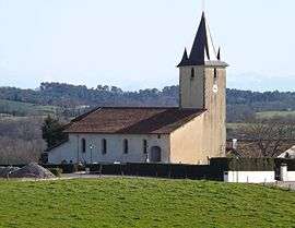
Mouscardès is a commune in the Landes department in Nouvelle-Aquitaine in southwestern France.
Population
| Historical population | ||
|---|---|---|
| Year | Pop. | ±% |
| 1793 | 426 | — |
| 1806 | 445 | +4.5% |
| 1821 | 418 | −6.1% |
| 1831 | 494 | +18.2% |
| 1841 | 476 | −3.6% |
| 1851 | 438 | −8.0% |
| 1861 | 437 | −0.2% |
| 1872 | 369 | −15.6% |
| 1881 | 392 | +6.2% |
| 1891 | 381 | −2.8% |
| 1901 | 383 | +0.5% |
| 1911 | 392 | +2.3% |
| 1921 | 335 | −14.5% |
| 1931 | 307 | −8.4% |
| 1946 | 296 | −3.6% |
| 1954 | 303 | +2.4% |
| 1962 | 297 | −2.0% |
| 1968 | 244 | −17.8% |
| 1975 | 239 | −2.0% |
| 1982 | 224 | −6.3% |
| 1990 | 218 | −2.7% |
| 1999 | 230 | +5.5% |
| 2008 | 279 | +21.3% |
| 2013 | 237 | −15.1% |
See also
References
| Wikimedia Commons has media related to Mouscardès. |
This article is issued from Wikipedia - version of the 11/10/2016. The text is available under the Creative Commons Attribution/Share Alike but additional terms may apply for the media files.