Saint-Jean-de-Lier
| Saint-Jean-de-Lier | |
|---|---|
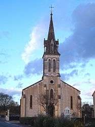 | |
 Saint-Jean-de-Lier | |
|
Location within Nouvelle-Aquitaine region  Saint-Jean-de-Lier | |
| Coordinates: 43°47′26″N 0°52′39″W / 43.7906°N 0.8775°WCoordinates: 43°47′26″N 0°52′39″W / 43.7906°N 0.8775°W | |
| Country | France |
| Region | Nouvelle-Aquitaine |
| Department | Landes |
| Arrondissement | Dax |
| Canton | Montfort-en-Chalosse |
| Intercommunality | Montfort-en-Chalosse |
| Government | |
| • Mayor (2001–2008) | Michel Daguinos |
| Area1 | 8.15 km2 (3.15 sq mi) |
| Population (2013)2 | 413 |
| • Density | 51/km2 (130/sq mi) |
| Time zone | CET (UTC+1) |
| • Summer (DST) | CEST (UTC+2) |
| INSEE/Postal code | 40263 / 40380 |
| Elevation |
6–43 m (20–141 ft) (avg. 12 m or 39 ft) |
|
1 French Land Register data, which excludes lakes, ponds, glaciers > 1 km² (0.386 sq mi or 247 acres) and river estuaries. 2 Population without double counting: residents of multiple communes (e.g., students and military personnel) only counted once. | |
Saint-Jean-de-Lier is a commune in the Landes department in Nouvelle-Aquitaine in southwestern France.
Population
| Historical population | ||
|---|---|---|
| Year | Pop. | ±% |
| 1793 | 212 | — |
| 1806 | 225 | +6.1% |
| 1821 | 200 | −11.1% |
| 1831 | 469 | +134.5% |
| 1841 | 509 | +8.5% |
| 1851 | 550 | +8.1% |
| 1861 | 533 | −3.1% |
| 1872 | 568 | +6.6% |
| 1881 | 557 | −1.9% |
| 1891 | 529 | −5.0% |
| 1901 | 521 | −1.5% |
| 1911 | 527 | +1.2% |
| 1921 | 437 | −17.1% |
| 1931 | 421 | −3.7% |
| 1946 | 373 | −11.4% |
| 1954 | 325 | −12.9% |
| 1962 | 360 | +10.8% |
| 1968 | 353 | −1.9% |
| 1975 | 316 | −10.5% |
| 1982 | 321 | +1.6% |
| 1990 | 309 | −3.7% |
| 1999 | 323 | +4.5% |
| 2008 | 347 | +7.4% |
| 2013 | 413 | +19.0% |
See also
References
| Wikimedia Commons has media related to Saint-Jean-de-Lier. |
This article is issued from Wikipedia - version of the 11/10/2016. The text is available under the Creative Commons Attribution/Share Alike but additional terms may apply for the media files.