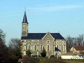
Le Vignau
| Le Vignau | |
|---|---|
 | |
 Le Vignau | |
|
Location within Nouvelle-Aquitaine region  Le Vignau | |
| Coordinates: 43°46′45″N 0°17′15″W / 43.7792°N 0.2875°WCoordinates: 43°46′45″N 0°17′15″W / 43.7792°N 0.2875°W | |
| Country | France |
| Region | Nouvelle-Aquitaine |
| Department | Landes |
| Arrondissement | Mont-de-Marsan |
| Canton | Grenade-sur-l'Adour |
| Intercommunality | Pays Grenadois |
| Government | |
| • Mayor (2014–2020) | Guy Revel |
| Area1 | 11.07 km2 (4.27 sq mi) |
| Population (2013)2 | 507 |
| • Density | 46/km2 (120/sq mi) |
| Time zone | CET (UTC+1) |
| • Summer (DST) | CEST (UTC+2) |
| INSEE/Postal code | 40329 / 40270 |
| Elevation |
72–132 m (236–433 ft) (avg. 105 m or 344 ft) |
|
1 French Land Register data, which excludes lakes, ponds, glaciers > 1 km² (0.386 sq mi or 247 acres) and river estuaries. 2 Population without double counting: residents of multiple communes (e.g., students and military personnel) only counted once. | |
Le Vignau is a commune in the Landes department in Nouvelle-Aquitaine in southwestern France.
Population
| Historical population | ||
|---|---|---|
| Year | Pop. | ±% |
| 1793 | 900 | — |
| 1806 | 605 | −32.8% |
| 1821 | 498 | −17.7% |
| 1831 | 608 | +22.1% |
| 1841 | 601 | −1.2% |
| 1851 | 657 | +9.3% |
| 1861 | 639 | −2.7% |
| 1872 | 643 | +0.6% |
| 1881 | 578 | −10.1% |
| 1891 | 505 | −12.6% |
| 1901 | 543 | +7.5% |
| 1911 | 481 | −11.4% |
| 1921 | 415 | −13.7% |
| 1931 | 385 | −7.2% |
| 1946 | 363 | −5.7% |
| 1954 | 355 | −2.2% |
| 1962 | 385 | +8.5% |
| 1968 | 383 | −0.5% |
| 1975 | 355 | −7.3% |
| 1982 | 374 | +5.4% |
| 1990 | 391 | +4.5% |
| 1999 | 385 | −1.5% |
| 2008 | 465 | +20.8% |
| 2013 | 507 | +9.0% |
See also
References
| Wikimedia Commons has media related to Le Vignau. |
This article is issued from Wikipedia - version of the 11/10/2016. The text is available under the Creative Commons Attribution/Share Alike but additional terms may apply for the media files.