Sindères
| Sindères | |
|---|---|
|
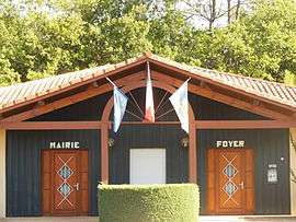
Town hall | |
 Sindères | |
|
Location within Nouvelle-Aquitaine region  Sindères | |
| Coordinates: 44°01′39″N 0°59′01″W / 44.0275°N 0.9836°WCoordinates: 44°01′39″N 0°59′01″W / 44.0275°N 0.9836°W | |
| Country | France |
| Region | Nouvelle-Aquitaine |
| Department | Landes |
| Arrondissement | Mont-de-Marsan |
| Canton | Morcenx |
| Intercommunality | Pays Morcenais |
| Government | |
| • Mayor (2014–2020) | Antoine Menaut |
| Area1 | 20.34 km2 (7.85 sq mi) |
| Population (2013)2 | 187 |
| • Density | 9.2/km2 (24/sq mi) |
| Time zone | CET (UTC+1) |
| • Summer (DST) | CEST (UTC+2) |
| INSEE/Postal code | 40302 / 40110 |
| Elevation |
56–96 m (184–315 ft) (avg. 78 m or 256 ft) |
|
1 French Land Register data, which excludes lakes, ponds, glaciers > 1 km² (0.386 sq mi or 247 acres) and river estuaries. 2 Population without double counting: residents of multiple communes (e.g., students and military personnel) only counted once. | |
Sindères is a commune in the Landes department in Nouvelle-Aquitaine in southwestern France.
Population
| Historical population | ||
|---|---|---|
| Year | Pop. | ±% |
| 1793 | 192 | — |
| 1806 | 163 | −15.1% |
| 1821 | 261 | +60.1% |
| 1831 | 261 | +0.0% |
| 1841 | 253 | −3.1% |
| 1851 | 285 | +12.6% |
| 1861 | 251 | −11.9% |
| 1872 | 366 | +45.8% |
| 1881 | 353 | −3.6% |
| 1891 | 349 | −1.1% |
| 1901 | 332 | −4.9% |
| 1911 | 313 | −5.7% |
| 1921 | 303 | −3.2% |
| 1931 | 240 | −20.8% |
| 1946 | 169 | −29.6% |
| 1954 | 185 | +9.5% |
| 1962 | 181 | −2.2% |
| 1968 | 210 | +16.0% |
| 1975 | 174 | −17.1% |
| 1982 | 134 | −23.0% |
| 1990 | 154 | +14.9% |
| 1999 | 179 | +16.2% |
| 2008 | 186 | +3.9% |
| 2013 | 187 | +0.5% |
See also
References
| Wikimedia Commons has media related to Sindères. |
This article is issued from Wikipedia - version of the 11/10/2016. The text is available under the Creative Commons Attribution/Share Alike but additional terms may apply for the media files.