Pey
For the Hebrew letter, see pe (letter).
| Pey | |
|---|---|
|
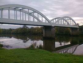
La Marquèze Bridge between Josse and Pey | |
 Pey | |
|
Location within Nouvelle-Aquitaine region  Pey | |
| Coordinates: 43°37′55″N 1°12′02″W / 43.6319°N 1.2006°WCoordinates: 43°37′55″N 1°12′02″W / 43.6319°N 1.2006°W | |
| Country | France |
| Region | Nouvelle-Aquitaine |
| Department | Landes |
| Arrondissement | Dax |
| Canton | Peyrehorade |
| Intercommunality | Pays d'Orthe |
| Government | |
| • Mayor (2014–2020) | Roland Ducamp |
| Area1 | 13.85 km2 (5.35 sq mi) |
| Population (2013)2 | 698 |
| • Density | 50/km2 (130/sq mi) |
| Time zone | CET (UTC+1) |
| • Summer (DST) | CEST (UTC+2) |
| INSEE/Postal code | 40222 / 40300 |
| Elevation |
2–57 m (6.6–187.0 ft) (avg. 30 m or 98 ft) |
|
1 French Land Register data, which excludes lakes, ponds, glaciers > 1 km² (0.386 sq mi or 247 acres) and river estuaries. 2 Population without double counting: residents of multiple communes (e.g., students and military personnel) only counted once. | |
Pey is a commune in the Landes department in Nouvelle-Aquitaine in southwestern France.
Population
| Historical population | ||
|---|---|---|
| Year | Pop. | ±% |
| 1793 | 570 | — |
| 1806 | 572 | +0.4% |
| 1821 | 720 | +25.9% |
| 1831 | 773 | +7.4% |
| 1841 | 858 | +11.0% |
| 1851 | 858 | +0.0% |
| 1861 | 811 | −5.5% |
| 1872 | 851 | +4.9% |
| 1881 | 881 | +3.5% |
| 1891 | 800 | −9.2% |
| 1901 | 788 | −1.5% |
| 1911 | 706 | −10.4% |
| 1921 | 645 | −8.6% |
| 1931 | 642 | −0.5% |
| 1946 | 591 | −7.9% |
| 1954 | 593 | +0.3% |
| 1962 | 607 | +2.4% |
| 1968 | 609 | +0.3% |
| 1975 | 575 | −5.6% |
| 1982 | 563 | −2.1% |
| 1990 | 564 | +0.2% |
| 1999 | 544 | −3.5% |
| 2008 | 701 | +28.9% |
| 2013 | 698 | −0.4% |
See also
References
| Wikimedia Commons has media related to Pey (Landes). |
This article is issued from Wikipedia - version of the 11/10/2016. The text is available under the Creative Commons Attribution/Share Alike but additional terms may apply for the media files.