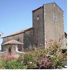
Saint-Étienne-d'Orthe
| Saint-Étienne-d'Orthe | |
|---|---|
 | |
 Saint-Étienne-d'Orthe | |
|
Location within Nouvelle-Aquitaine region  Saint-Étienne-d'Orthe | |
| Coordinates: 43°35′17″N 1°10′37″W / 43.5881°N 1.1769°WCoordinates: 43°35′17″N 1°10′37″W / 43.5881°N 1.1769°W | |
| Country | France |
| Region | Nouvelle-Aquitaine |
| Department | Landes |
| Arrondissement | Dax |
| Canton | Peyrehorade |
| Intercommunality | Pays d'Orthe |
| Government | |
| • Mayor (2014–2020) | Jean Petrau |
| Area1 | 11.07 km2 (4.27 sq mi) |
| Population (2013)2 | 669 |
| • Density | 60/km2 (160/sq mi) |
| Time zone | CET (UTC+1) |
| • Summer (DST) | CEST (UTC+2) |
| INSEE/Postal code | 40256 / 40300 |
| Elevation |
2–57 m (6.6–187.0 ft) (avg. 45 m or 148 ft) |
|
1 French Land Register data, which excludes lakes, ponds, glaciers > 1 km² (0.386 sq mi or 247 acres) and river estuaries. 2 Population without double counting: residents of multiple communes (e.g., students and military personnel) only counted once. | |
Saint-Étienne-d'Orthe is a commune in the Landes department in Nouvelle-Aquitaine in southwestern France.
Population
| Historical population | ||
|---|---|---|
| Year | Pop. | ±% |
| 1793 | 605 | — |
| 1806 | 602 | −0.5% |
| 1821 | 791 | +31.4% |
| 1831 | 810 | +2.4% |
| 1841 | 779 | −3.8% |
| 1851 | 830 | +6.5% |
| 1861 | 807 | −2.8% |
| 1872 | 795 | −1.5% |
| 1881 | 836 | +5.2% |
| 1891 | 793 | −5.1% |
| 1901 | 749 | −5.5% |
| 1911 | 748 | −0.1% |
| 1921 | 644 | −13.9% |
| 1931 | 578 | −10.2% |
| 1946 | 513 | −11.2% |
| 1954 | 507 | −1.2% |
| 1962 | 498 | −1.8% |
| 1968 | 502 | +0.8% |
| 1975 | 455 | −9.4% |
| 1982 | 439 | −3.5% |
| 1990 | 407 | −7.3% |
| 1999 | 466 | +14.5% |
| 2008 | 562 | +20.6% |
| 2013 | 669 | +19.0% |
See also
References
| Wikimedia Commons has media related to Saint-Étienne-d'Orthe. |
This article is issued from Wikipedia - version of the 11/10/2016. The text is available under the Creative Commons Attribution/Share Alike but additional terms may apply for the media files.